In the infrastructure, construction, and geospatial surveying sector, rapid and exact land documentation is vital to keep mega-projects moving safely.
In the quarter three of 2024, Al-Shalawi International Co. issued a formal purchase order commissioning a high-precision digital aerial mapping campaign.
This project represents an integral piece of the data framework supporting major infrastructure planning within Saudi Arabia’s Vision 2030 initiative.
The project site covered a defined expansion sector of approximately 9.5 square kilometers located within the Tabuk Region, designated as NEOM Project 029.
To establish the foundational blueprints for subsequent engineering phases, the survey team formally mobilized to the site towards the end of quarter three in 2024.
The core objective was clear: acquire absolute elevation data, generate high-resolution digital terrain models, and execute topographical feature extraction with survey-grade precision.
The Challenge: Overcoming Harsh Terrain & Visual Blind Spots
Executing a topographic survey in remote desert regions introduces significant operational obstacles that render conventional ground methods impractical:
- Severe Terrain Restrictions: The 9.5-square-kilometer project area was characterized by rugged terrain, steep valleys, and rocky canyons. Sending traditional surveying personnel on foot with manual GPS poles into these remote zones creates severe human safety risks and slow collection rates.
- Vegetation Barriers: Low-lying desert scrub and dense wadi shrubs naturally scatter across the landscape. Standard visual drone photography (photogrammetry) cannot see past this surface layer, which covers up the true elevation of the dirt underneath and leads to flawed volumetric calculations.
- The Precision Mandate: To eliminate infrastructure layout errors before construction earthworks begin, Al-Shalawi required an absolute 0.25-meter grid resolution for all topographic surface and terrain models. Achieving this layer of detail over a vast area required an alternative to slow, legacy surveying methods.
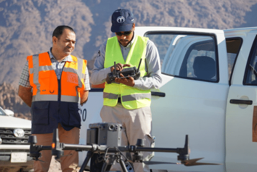
The Solution: Deploying Heavy-Duty Aerial LiDAR
To bypass the limitations of ground surveying and visual photography, the engineering team deployed a specialized aerial laser scanning system:
- Industrial Hardware Selection: The team utilized the DJI Matrice 350 RTK commercial drone. This platform was selected for its heavy-duty build, stable flight endurance of up to 55 minutes, and ability to operate reliably in challenging desert wind environments.
- Active Laser Scanning (LiDAR): The drone was equipped with a Zenmuse L2 LiDAR sensor. Rather than capturing a flat photo, this payload fires up to 240,000 laser pulses per second at the earth. Because the laser tracks multiple returns, it easily pierces the gaps in desert vegetation, striking the bare ground below to map the true surface shape.
- High-Precision Ground Reference: To anchor the aerial data to exact earth coordinates, the team deployed a Trimble R12 geodetic GNSS receiver on the ground. Instead of relying solely on real-time positioning, the laser point cloud was further corrected using Post-Processed Kinematic (PPK) software algorithms, locking in absolute point accuracies under 10 centimeters.

