التنبؤ الدقيق: بيانات جوية للاقتصاد منخفض الارتفاع للبنية التحتية للتوأم الرقمي.

فجوة بيانات المدن الكبرى المدن الذكية مثل نيوم أو الرياض ليست مجرد مجموعة من الخرسانة والزجاج. إنها أنظمة حية معقدة تتنفس وتتحرك وتستهلك الطاقة. تتطلب إدارة هذه التعقيدات ذكاءً في الوقت الفعلي. ومع ذلك، لا يزال العديد من مخططات المدن يعتمدون على المسوحات الأرضية الثابتة والخرائط القديمة. لا يمكنهم رؤية كيف أن ناطحة سحاب جديدة [...]
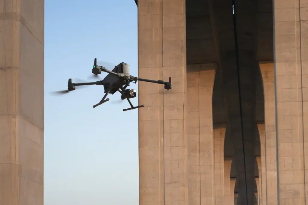
الاقتصاد على ارتفاع أقل من 1000 قدم: صعود LAE في المدن الذكية
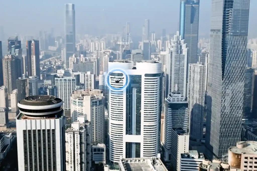
الطبقة الصناعية الجوية التالية غالبًا ما ننظر إلى السماء ونرى فراغًا. ومع ذلك، فإن ثورة هادئة تحدث فوق رؤوسنا مباشرة. هذا هو صعود اقتصاد الارتفاعات المنخفضة (LAE). يشير هذا المصطلح إلى مجال اقتصادي وتشغيلي جديد يشغل المجال الجوي دون 1000 قدم. إنه يمثل الـ [...]
روبوت أرضي رباعي الأرجل بدون مخاطر على البشر لفحص الصناعات الخطرة.
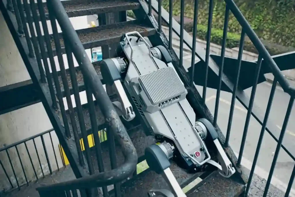
المخاطر غير المحلولة في التفتيش الأرضي الصناعي تتطلب المنشآت الصناعية، ومحطات الطاقة، وممرات خطوط الأنابيب، والأنفاق العميقة، ومواقع الإنشاءات الشاسعة مراقبة مستمرة. تقع هذه المراقبة تقليديًا على عاتق مفتشي الدوريات البشرية. يواجه هؤلاء العمال مخاطر شديدة ومستمرة: التعرض للغازات السامة، والحرارة الشديدة، والجهد العالي، والعقبات المعقدة، والتضاريس غير المستقرة. هذه الطريقة اليدوية للدوريات الأرضية تخلق [...]
إطار متكامل للتفتيش الجوي والبري والبحري لسلامة الأصول الصناعية
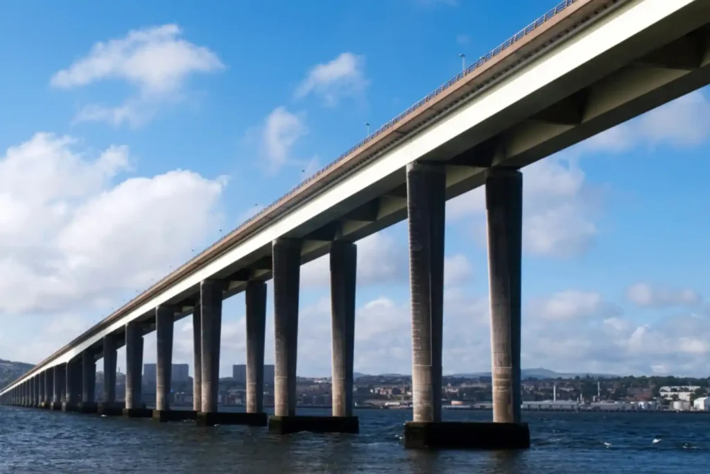
تحدي السلامة ثلاثية الأبعاد إدارة البنية التحتية الكبرى من خطوط الأنابيب والطرق السريعة البعيدة إلى مرافق النفط البحرية، هي مهمة ضخمة. يواجه أصحاب الأصول في منطقة الشرق الأوسط وشمال أفريقيا التحدي الهائل المتمثل في الحفاظ على السلامة الهيكلية عبر جميع البيئات الرئيسية الثلاث: الهواء (الأصول المرتفعة)، الأرض (الممرات الخطية)، والبحر (الأسس المغمورة). النهج التقليدي لإدارة هذه [...]
الحتمية الساحلية: لماذا يعد الرصد القائم على المركبات المسيرة عن بعد أمرًا ضروريًا للحفاظ على البنية التحتية البحرية والموانئ لرؤية السعودية 2030.
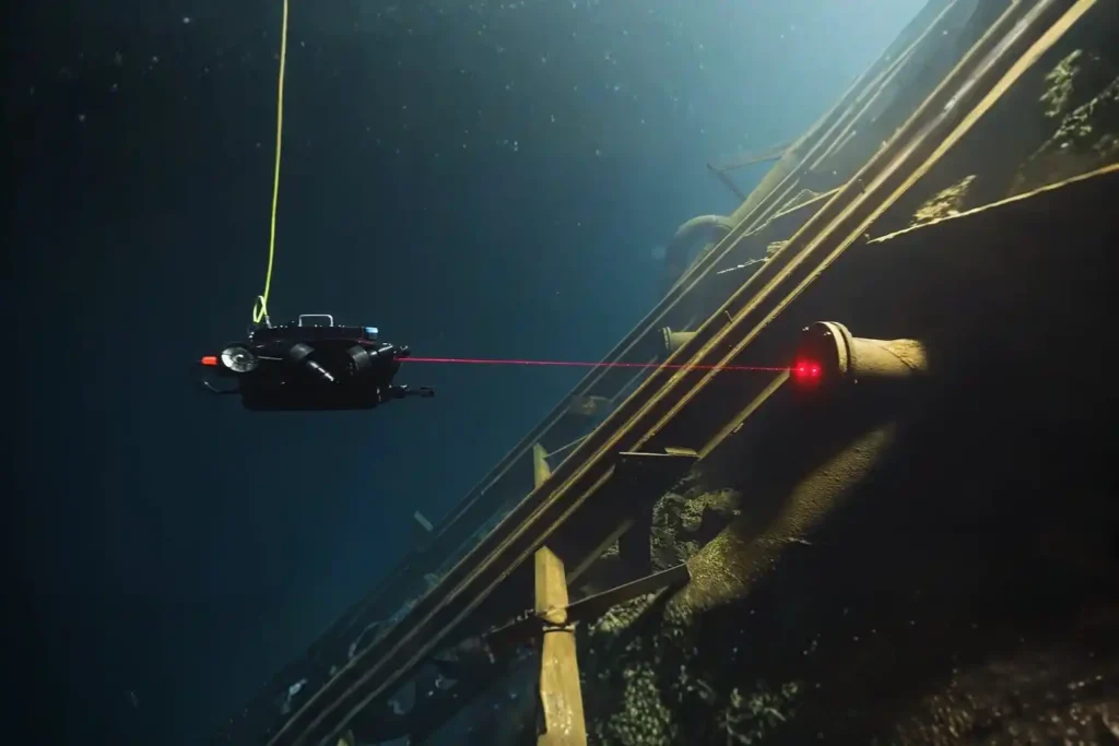
التحدي تحت السطح أسس اقتصاد الشرق الأوسط وشمال أفريقيا، والأرصفة، والجسور، والجدران البحرية، ومرافق الموانئ، ومنصات الطاقة البحرية. تعتمد هذه الأصول على البنية التحتية المغطاة بالمياه. وتواجه هذه الأصول عدوًا وحشيًا غير مرئي: البيئة البحرية. يؤدي التعرض المستمر لمياه البحر، شديدة التآكل، إلى فقدان المواد. ويتفاقم هذا التدهور الهيكلي بفعل نمو الكائنات البحرية، وهو […]
المراقبة باستخدام المركبات تحت المائية غير المأهولة (ROV) للبنية التحتية البحرية وأصول التفتيش الساحلي
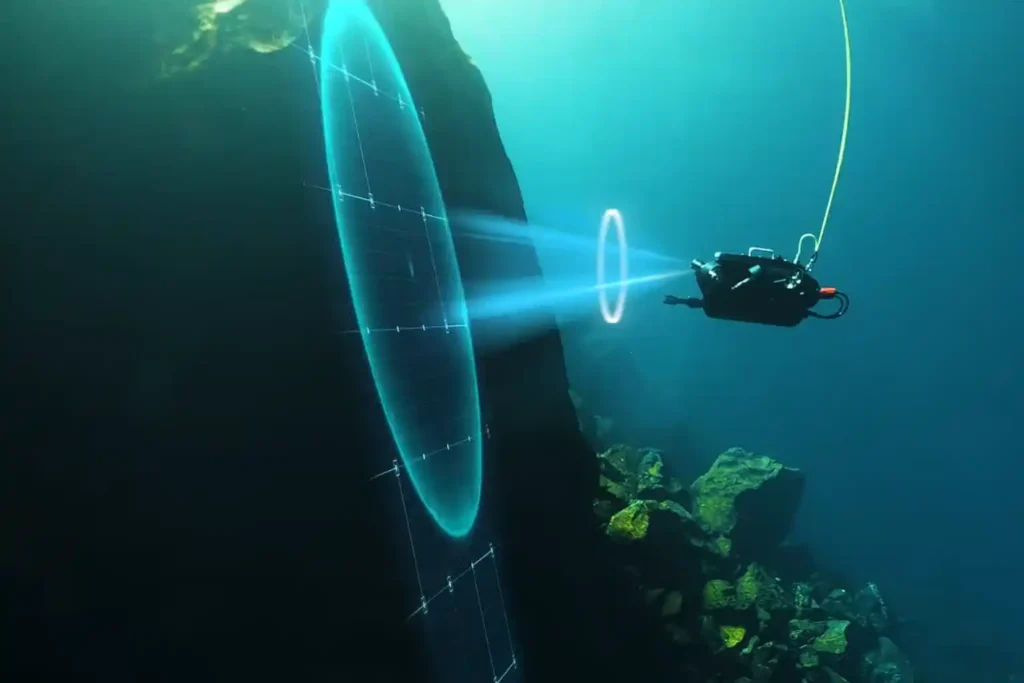
التحدي تحت السطح تعتمد أسس اقتصاد منطقة الشرق الأوسط وشمال أفريقيا - الأرصفة والجسور والجدران البحرية ومنشآت الموانئ ومنصات الطاقة البحرية - على البنية التحتية المغمورة. تواجه هذه الأصول عدوًا وحشيًا غير مرئي: البيئة البحرية. التعرض المستمر لمياه البحر، التي تتسم بالتآكل الشديد، يؤدي إلى فقدان المواد. يتفاقم هذا الاضمحلال الهيكلي بفعل التلوث البيولوجي - النمو السريع للكائنات البحرية [...]
وفر 95% من الوقت مع فحص التآكل القائم على الطائرات بدون طيار للأصول
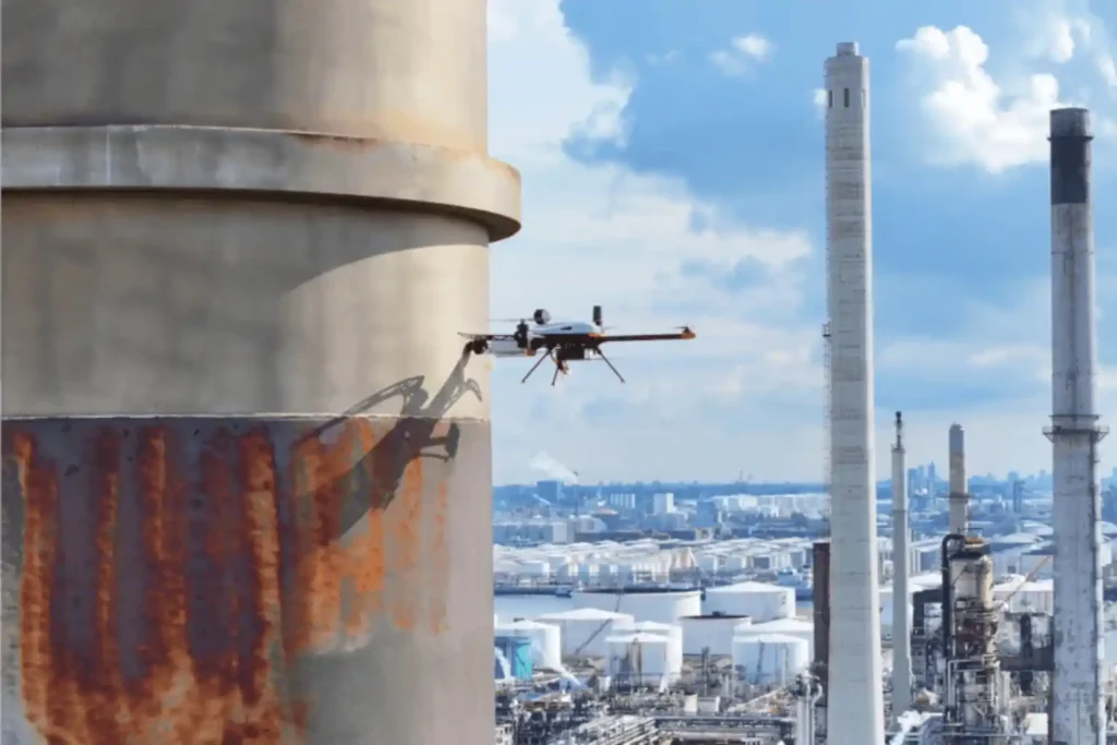
تحدي فحص التآكل التآكل هو العدو الصامت الذي لا يرحم للأصول المعدنية - يظل السبب الرئيسي للانقطاعات غير المخطط لها، وفشل الاحتواء، ومخاطر السلامة المدمرة عبر قطاعات النفط والغاز والبتروكيماويات والصناعات الثقيلة. في البيئات المتطلبة لمنطقة الشرق الأوسط وشمال أفريقيا، واجهت الأصول مثل خزانات التخزين وخطوط الأنابيب ومداخن الغاز المتوهج ظروفًا قاسية [...]
إحداث ثورة في فحص التآكل بأنظمة الطائرات بدون طيار البصرية وفوق الصوتية
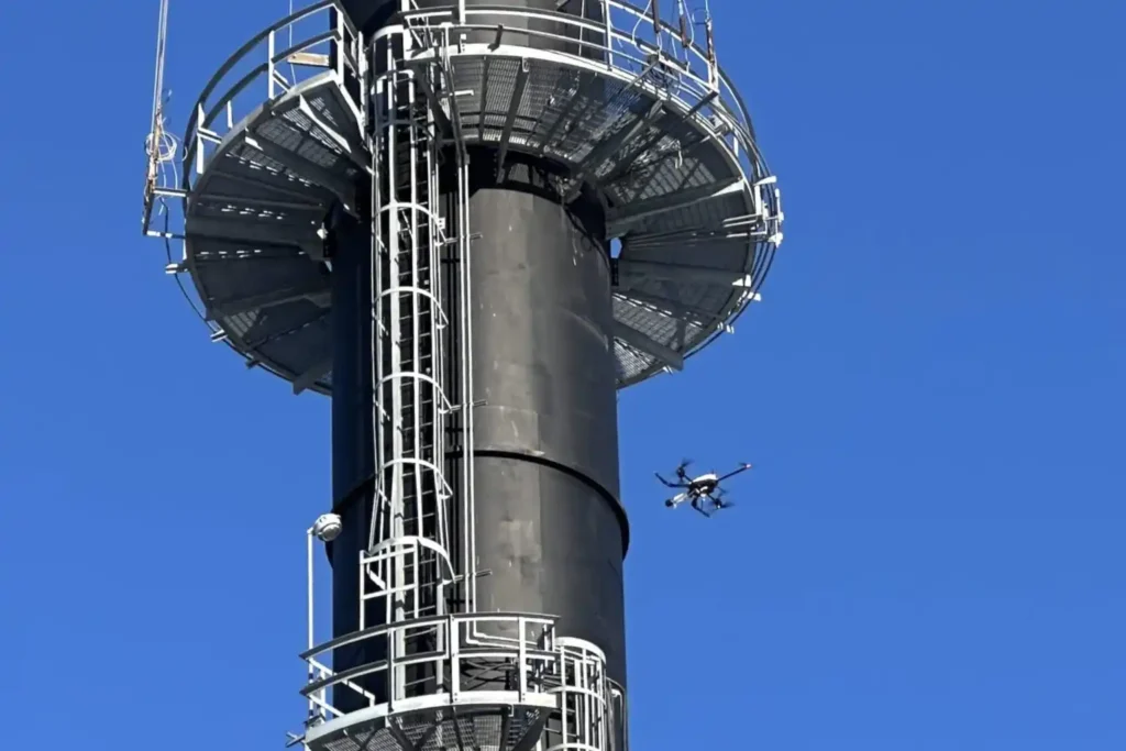
تحدي فحص التآكل. التآكل هو العدو الصامت الذي لا يرحم للأصول المعدنية - ويظل السبب الرئيسي للأعطال غير المخطط لها، وفشل الاحتواء، والمخاطر المدمرة للسلامة في قطاعات النفط والغاز والبتروكيماويات والصناعات الثقيلة. في البيئات المتطلبة في منطقة الشرق الأوسط وشمال أفريقيا، تواجه الأصول مثل خزانات التخزين وخطوط الأنابيب وأبراج اللهب ضغطًا شديدًا [...]
كيف تعزز الاستخبارات الجغرافية المكانية إدارة الأصول التنبؤية
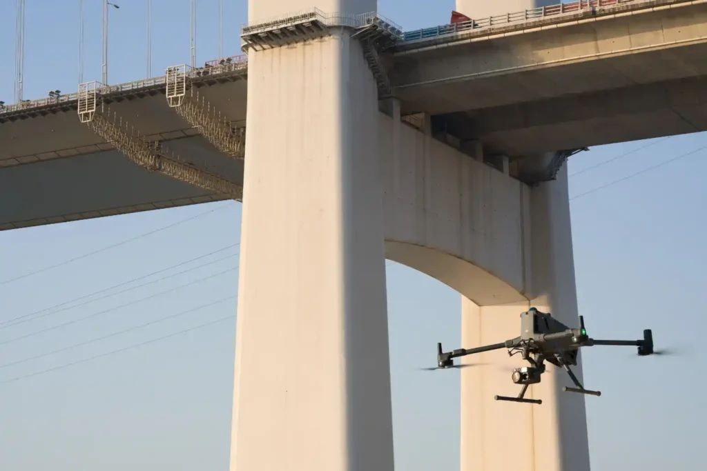
الحتمية التشغيلية لحظة انتهاء تشييد البنية التحتية مثل الطرق السريعة والجسور والأصول الصناعية، فإنها تدخل مرحلة جديدة حرجة: المخاطر التشغيلية. تعد إدارة الصيانة أكبر تكلفة طويلة الأجل، وفشل الإصلاح التفاعلي، والانتظار وقوع عطل قبل إصلاحه، أمر غير مقبول لأي مدينة ذكية حديثة. يكمن التحدي في الفحص. الفحوصات التقليدية للسلامة [...]
رسم الخرائط الدقيق: القلب التقني لتصميم الطرق السريعة عالية السرعة
المهمة الأساسية لبناء أو تحسين أي طريق رئيسي أو خط سكة حديد أو طريق سريع في منطقة الشرق الأوسط وشمال أفريقيا سريعة التطور هي رسم الخرائط الطبوغرافية. هذه العملية، التي تنشئ نموذجًا ثلاثي الأبعاد لسطح الأرض، ليست مجرد خطوة أولية؛ بل تحدد الجدوى الهندسية والميزانية والجدول الزمني النهائي للمشروع بأكمله. ومع ذلك، [...]
