كيف يجد نظام مكافحة الطائرات بدون طيار التهديدات المخفية
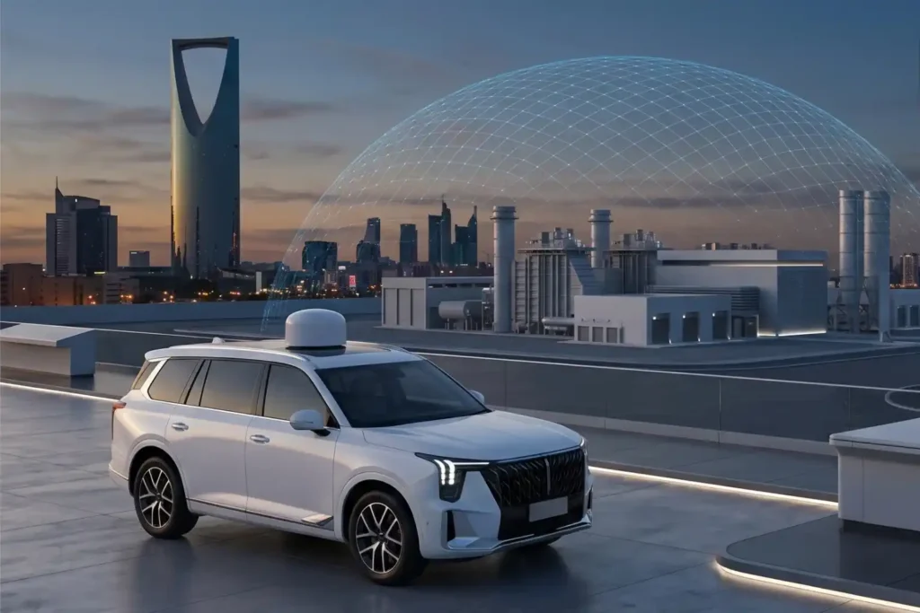
تواجه المواقع الصناعية الحديثة خطرًا جسيمًا من الطائرات بدون طيار منخفضة الارتفاع التي تتجنب الرادارات التقليدية. يمكن لهذه الطائرات غير المصرح بها الوصول إلى مناطق حساسة مثل مصافي النفط أو محطات الطاقة دون أن يتم اكتشافها. لوقفها، يجب على نظام مكافحة الطائرات بدون طيار اكتشاف هذه الأهداف في أقرب وقت ممكن. يتطلب ذلك الابتعاد عن أجهزة الاستشعار الصاخبة واستخدام أجهزة استشعار صامتة [...]
كيف تقلل الطائرات بدون طيار التكاليف بمقدار 951 تي بي 3 تي في الساعة في مجال إدارة الكوارث

يمكن للطائرات بدون طيار أن تلعب دورًا حيويًا في الاستجابة السريعة للطوارئ وإدارة الكوارث. لطالما عانت الطرق التقليدية من تأخر الاستجابة، والوصول المحدود، وعدم وجود وعي ظرفي في الوقت الفعلي. يمكن لهذه القيود أن تحدث فرقًا بين الحياة والموت في سيناريوهات عالية المخاطر مثل الزلازل أو الحرائق الصناعية أو التجمعات العامة واسعة النطاق. اليوم، تقوم الطائرات بدون طيار [...]
الزراعة بالصور الفضائية: دقة حديثة

الزراعة باستخدام صور الأقمار الصناعية تُحدث تحولاً في كيفية إدارة المزارعين للموارد وتحسين المحاصيل. من خلال الاستفادة من بيانات الأقمار الصناعية المتقدمة، يكتسب المزارعون رؤية شاملة لحقولهم، مما يمكنهم من مراقبة صحة التربة، وتحسين نمو المحاصيل، واتخاذ قرارات مستندة إلى البيانات. هذه التقنية تعزز الإنتاجية وتلبي الطلب المتزايد على ممارسات زراعية مستدامة. الفوائد الرئيسية لـ [...]
الدليل الإرشادي لاختيار الطائرة بدون طيار الأنسب من أسطول طائرات شركة DJI، اعتماداً على الاحتياجات الوظيفية والتطبيقات المختلفة لكل مجال.

مقدمة طائرات DJI المسيرة هي علامة تجارية مرموقة للطائرات المسيرة تستخدم في مختلف الصناعات. تلبي طائراتهم المسيرة احتياجات مختلفة، سواء كان ذلك للمزارعين الذين يراقبون المحاصيل، أو المصورين الذين يلتقطون لقطات جوية، أو العمال الذين يفحصون المباني. مع مجموعة متنوعة من الطائرات المسيرة، أصبحت DJI Drone خيارًا موثوقًا به لأولئك الذين يتطلعون إلى الاستفادة من تكنولوجيا الطائرات المسيرة في عملهم، وعرض [...]
