
Executive summary
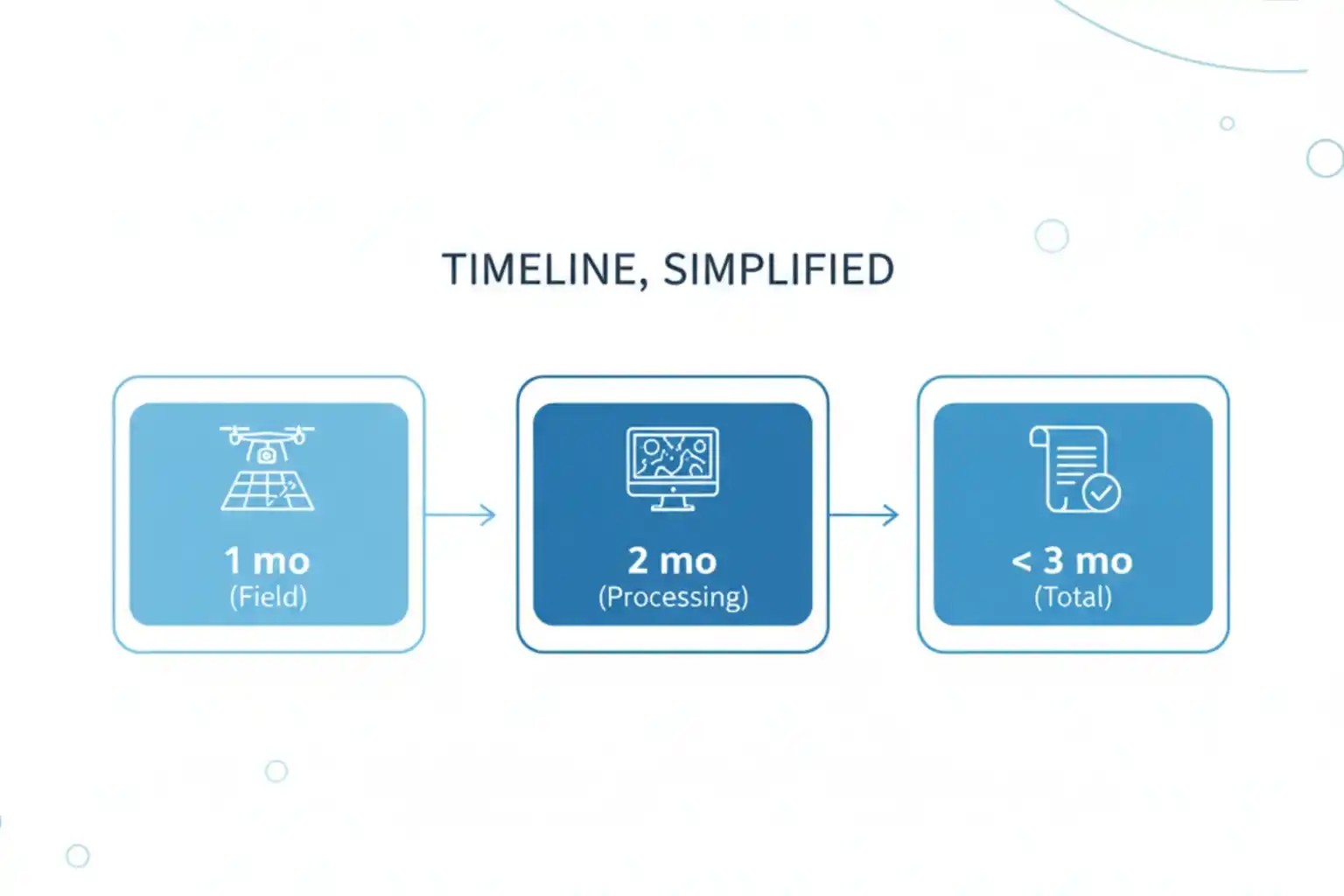
We delivered a coastal topographic map to support mangrove planning and environmental impact assessment across 102 km² split into 13 shoreline blocks في Jubail and Ras Al Khair. Field data collection finished in 1 month. Processing took 2 months. The program concluded in under 3 months end-to-end, significantly faster than a traditional coastal campaign.
Why coastal topography is hard
Shorelines introduce real operational friction. Access is limited. Safety risks rise. Above all, tide windows control when you can work and for how long, which stretches ground schedules and complicates repeatable measurements. A conventional approach in these conditions becomes slow and difficult.
Method overview: hybrid LiDAR + photogrammetry
We selected a hybrid workflow that combines airborne LiDAR for structure-through-vegetation and elevation fidelity with photogrammetry for high-resolution textures and planimetrics. This approach hits accuracy and coverage targets for coastal ecosystems, mangrove planning, and EIA deliverables.
Platforms and control
- تحكم High-grade GNSS using تريمبل آر 12 for Primary Reference, GCPs used in adjustment, and ICPs held blind for validation and accuracy reporting.
- Multiplatform capture:
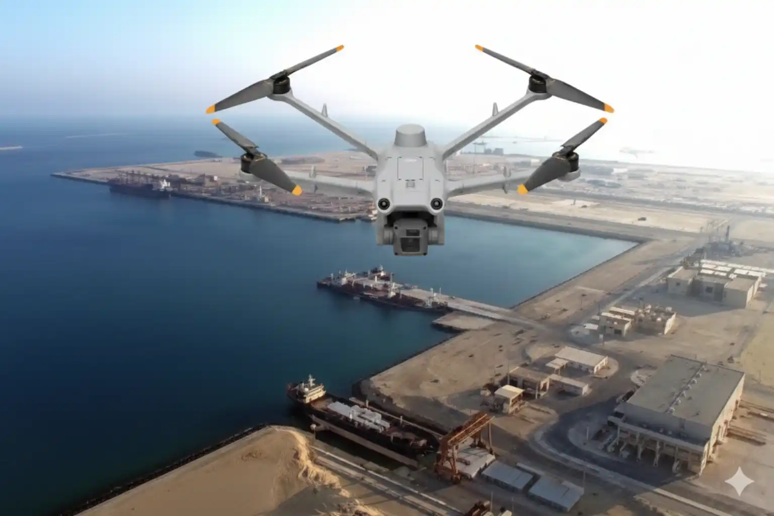
- دي جي آي إم 350 آر تي كيه مع زينموز بي 1 (imagery) and زينموز L2 (LiDAR) for flexible sorties over irregular shorelines.
- Trinity Pro مع Sony LR-1 و Qube640 to extend corridor efficiency and coverage per flight.
Acquisition strategy
We divided the shoreline into 13 blocks and scheduled missions inside tide windows to balance safety and data quality. This playbook completed capture in 1 month and kept datasets comparable across sites despite changing coastal conditions.
Processing workflow and QA
Inputs included LiDAR point clouds, geotagged photos, and the full GCP/ICP set. We aligned and adjusted the block network, generated a دي إس إم and bare-earth DTM, built the أورثوموزايك, and created ملامح و ثنائي الأبعاد CAD. We computed residuals on independent checkpoints and packaged the تقييم الدقة و تقرير المسح for sign-off.
Results that matter
- Time: Delivered in < 3 months, compared with a conventional estimate of ~ 6 months in this setting.
- Quality and efficiency: The program lists improved accuracy, faster turnaround, cost reduction, ، و increased safety as the primary benefits.
- امتثال Topography is compliant with consultant standards and industry best practice, making it suitable for EIA workflows.
- Safety gain: We reduced tidal-zone exposure by eliminating most on-foot survey inside areas that flood at high tide.
What stakeholders receive
A complete, design-ready package: GCP and ICP coordinate lists, أورثوموزايك, دي إس إم, DTM, ملامح, 2D CAD drawings, plus an تقييم الدقة و تقرير المسح for traceability and sign-off.
Implementation checklist
Send AOI geometry, target scale, و فاصل الكنتور, accuracy tolerances, CRS/vertical datum, relevant tide tables, and any permit constraints. This ensures that block planning, control layout, and compliance steps are implemented correctly the first time.
ابدأ الآن
Share your AOI and requirements. We will return a scoped plan with flight blocks, control layout, QA gates, and a delivery schedule aligned to your milestones. Included at no cost for kickoff: free 3-month progress monitoring with monthly milestone updates, QA-gate briefs, a simple status dashboard for field and processing stages, and a pilot block validation with a sample tile under NDA for early stakeholder review.

