Economy under 1,000 Feet: The Rise of LAE in Smart Cities
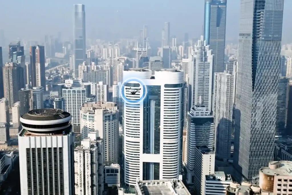
The Next Industrial Airspace Layer We often look at the sky and see empty space. However, a quiet revolution is happening just above our heads. This is the rise of the low altitude economy (LAE). This term refers to a new economic and operational domain occupying the airspace below 1,000 feet. It represents the next frontier for industrial efficiency. Global industries are moving fast. They are digitizing their airspace and adopting unmanned systems to perform autonomous inspections. This shift is not just a global trend; it is a critical component of Saudi Arabia’s Vision 2030. The Kingdom is building smart cities and transforming its industrial base. These massive projects require accurate, safe, and continuous aerial operations. Traditional ground methods cannot support this scale. The low altitude economy and industrial applications provide the only viable solution to manage these large-scale assets efficiently. Core Technologies Enabling the LAE To make this new economy work, we need a robust technological foundation. The LAE relies on a stack of advanced systems that ensure safety and predictability. I. The Technological Stack for Safe Operations Unmanned Traffic Management (UTM): We cannot have drones flying blindly. UTM acts like air traffic control for drones. It coordinates airspace, ensures compliance, and prevents collisions. BVLOS Frameworks: Real value comes when drones fly Beyond Visual Line of Sight (BVLOS). This framework establishes safe corridors for drones to operate over long distances, such as along pipelines, utility grids, and coastal zones. Autonomous Drone Stations: Efficiency demands persistence. Autonomous docking stations allow drones to land, charge, and deploy 24/7 without a human pilot on site. Remote Sensing Toolkit: The drone is just the carrier. The value lies in the sensors. We use LiDAR for depth, thermal imaging for heat detection, multispectral sensors for vegetation analysis, and methane detectors for gas leaks. Geospatial Data Infrastructure: All this data must go somewhere. We build high-resolution maps and GIS databases. These form the basis of digital twins, allowing operators to manage physical assets in a digital space. These systems interact seamlessly. They create a predictable and scalable workflow that transforms low altitude economy and industrial applications from a concept into a daily operational reality. Transforming Critical Sectors The application of this technology transforms how we manage the three pillars of modern society: Energy, Utilities, and Urban Development. II. Energy Sector Applications The energy sector demands the highest level of safety and monitoring. Pipeline Integrity: Drones monitor the Right-of-Way (ROW) along vast pipeline networks. They detect leaks and security breaches instantly, protecting the environment and the asset. Flare and Tank Inspection: We replace dangerous manual climbing with drone inspections. Drones perform visual, thermal, and Ultrasonic Thickness (UT) checks on flare stacks and storage tanks. This assesses corrosion and wall health without shutting down operations. Sustainability: Specialized sensors quantify methane and Greenhouse Gas (GHG) emissions. This data helps energy companies meet strict regulatory compliance and sustainability goals. III. Utilities and Power Infrastructure Grid reliability is non-negotiable. Drones ensure the lights stay on. Powerline Inspection: Drones capture high-resolution visual and thermal images of powerlines. LiDAR sensors measure the sag of the lines with centimeter precision. Vegetation Management: Overgrown trees cause outages. Drones analyze vegetation encroachment, allowing utility companies to trim trees only where necessary. Renewable Assets: As the Kingdom adopts green energy, drones inspect solar PV panels for dead cells and wind turbines for blade damage, ensuring maximum energy output. IV. Urban Development and Smart Cities Smart cities like NEOM require smart construction data. Digital Twins: Drones capture data to build 3D city models. These Digital Twins allow planners to simulate traffic, weather, and energy usage before building anything. Progress Tracking: Megaprojects move fast. Aerial surveys track construction progress day by day. This helps project managers catch errors early and keep the project on schedule. Environmental Monitoring: Sensors on drones monitor air quality and heat islands in urban areas. This data helps city planners design cooler, healthier living spaces. Accelerating Efficiency and Adoption The shift to the low altitude economy and industrial applications is not just about technology; it is about business results. V. Why LAE Accelerates Efficiency Cost and Frequency: Automated drones inspect assets more frequently at a lower cost. You can inspect a site daily instead of monthly. Human Safety: We remove humans from high-risk environments. No more climbing towers or entering confined tanks. Real-Time Data: Reports arrive in near real-time. This integration with enterprise systems allows for faster decision-making. National Scale: This technology supports cross-sector interoperability. Data collected for a road project can also help utility companies, supporting national-scale digital initiatives. VI. Pathway to Adoption Governments and industry operators must act now to build this ecosystem. Establish Readiness: Organizations must prepare their technical systems for BVLOS and UTM-aligned operations. Deploy Autonomy: Install autonomous drone stations to enable routine, high-frequency missions. Centralize Data: Build repositories to unify survey and inspection data. Start Pilots: Conduct pilot programs with measurable KPIs to prove the value. Ready to transform your low altitude economy energy, utility, or urban development projects? Let’s realize it through advanced sensing, processing, and data management platforms.
Quadruped Ground Robot with Zero Human Risk For Hazardous Industrial Inspections.
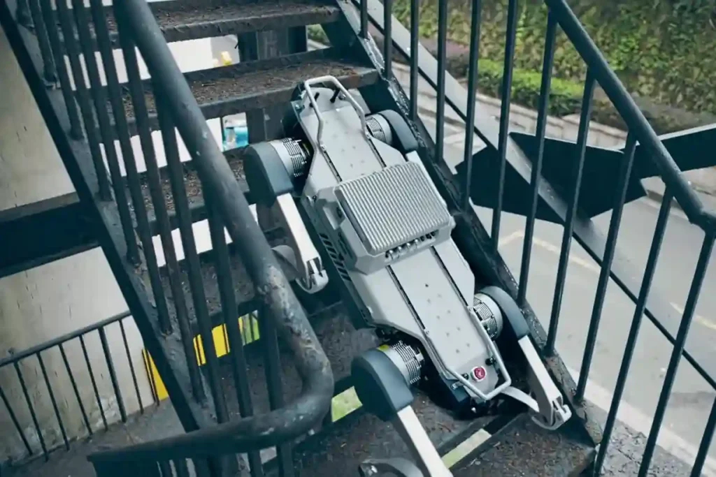
The Unsolved Risk in Industrial Ground Inspection Industrial facilities, power plants, pipeline corridors, deep tunnels, and vast construction sites demand continuous oversight. This oversight traditionally falls to human patrol inspectors. These workers face constant, severe hazards: exposure to toxic gases, extreme heat, high voltage, complex obstacles, and unstable terrain. This manual ground patrol method creates two major problems: High Risk: It constantly puts personnel in harm’s way, leading to potential injuries and high operational safety costs. Low Efficiency: Patrols are repetitive, slow, and often yield subjective data. The need for constant human supervision reduces efficiency and increases labor costs. Modern industry requires a solution that is tireless, fearless, and precise. The necessary transformation is intelligent, unmanned inspection using specialized ground robots. This powerful shift to ground robotics for inspection eliminates human exposure while ensuring that critical assets are monitored $24/7$. Core Technical Capabilities and Industrial Application The solution to the ground risk problem is the agile autonomy and rugged design of the Deep Robotics X30 quadruped robot. This machine is built specifically to operate where humans cannot, turning hazardous patrol routes into repeatable, digital missions. I. Core Technical Advantage: All-Terrain Autonomy The X30 platform’s mechanical and digital architecture guarantees performance and reliability in the MENA region’s challenging industrial environments. A. All-Weather, All-Terrains Coverage The X30’s physical design overcomes almost any obstacle. Extreme Protection: The robot boasts industrial protection above IP66, making it waterproof and dustproof. This allows it to operate continuously for 24 hours in severe operating environments such as heavy rain, snow, or hail. Superior Mobility: It achieves superior mobility by easily navigating obstacles and unstructured surfaces. It can climb stairs up to a 45° slope, stably climb hollow industrial stairs, and move freely through complex environments like ruins, gravel, stone mills, and rough grasslands. This capability minimizes disturbance to the scene and reduces the chance of secondary accidents. Adaptation: The robot exhibits strong adaptation capability, achieving rapid deployment for high-precision data acquisition, analysis, and danger warning. B. Smart Digital Transformation and Control The X30 is fundamentally a digital asset, designed to integrate seamlessly into a centralized control environment. Closed-Loop Workflow: The navigation system handles complex business processes. The Smart Controller simultaneously processes navigation and business-related programs, primarily providing map construction and location navigation. This system enables a closed-loop workflow: High-precision auto-navigation, auto-charge, automatic data capture, and real-time data upload to the superior site. Risk Detection: The entire process connects to the centralized control system. Real-time data syncs immediately, allowing the system to detect potential defects in time to prevent incidents, ensuring the safe operation of equipment. II. Application Deep Dive: Power & Utilities (P&U) and Tunnels The X30 directly supports the transformation of routine asset monitoring within critical infrastructure. A. Autonomous Inspection Workflow for P&U The X30 facilitates efficient, digital, intelligent inspection with a simple autonomous workflow: Path Planning: Operators explore targets and set up the inspection path and mission. Execution: The robot performs real-time inspection based on pre-set navigation paths. Reporting and Charge: It generates real-time results and reports, and then returns for auto-charge, preparing for the next inspection cycle. Advanced Sensing: The robot uses a Bi-spectrum Camera (infrared/visible light) for intelligent recognition and defect alarm analysis. It also features an Acoustic Imager to achieve precise sound source positioning, helping to accurately distinguish and quickly troubleshoot different types of partial discharge (like corona or floating discharge). Remote Action: Equipped with an Agile Robotic Arm, the X30 can execute remote tasks such as grabbing, switching doors, or picking up items, enabling unmanned operation and maintenance. B. High-Accuracy Inspection in Tunnels and Mining The X30 excels in linear, complex, and hazardous underground environments, replacing human patrol inspectors. Tunnels and Underground Cable Corridors: The X30 is capable of fully unmanned autonomous inspection in complex terrains of underground cable tunnels. It prevents manned errors in traditional inspection, improving monitoring efficiency and reducing risk from high-temperature or toxic environments. Metal & Mining: The robot patrols complex environments such as narrow pipes, heavy dust areas, and muddy roads. This capability greatly reduces the exposure of patrol inspectors to potential hazards, improving efficiency and preventing equipment failures ahead of time. High-Risk Specializations and Value The value of the X30 is maximized when it is deployed to situations of extreme risk, where its robust safety features save lives and minimize financial loss. III. Application Deep Dive: Rescue Operations and Construction The X30’s ability to operate in severely compromised environments makes it an ideal robotic partner for emergency services and quality assurance. A. Smart Rescue Workflow The X30 is designed to replace rescue personnel in high-risk environments for search and rescue work. Hazard Detection: The robot ventures into the post-disaster area, captures images, and transmits them back. It identifies hazardous gases using integrated Gas Sensors (detecting carbon monoxide, hydrogen sulfide, etc.) and collects temperature data via thermal imaging. It then devises the safest evacuation route. Communication and Support: The robot can collect sounds from trapped individuals using the Pickup feature and establish essential communication with them. It also has load operation capabilities, enabling it to carry supplies or equipment to the disaster site. Resilience: Its all-weather, all-terrains coverage allows it to traverse $20 \text{ cm}$ obstacles and $30^\circ$ slopes on ruins and rubble, minimizing disturbance to the scene and reducing the chance of secondary accidents. B. Construction and Factory Inspection The X30’s precise mobility and sensing capabilities translate into significant efficiency gains in construction and manufacturing settings. Construction Mapping: The robot assists with auxiliary surveying and mapping in complex environments. Combining its excellent obstacle avoidance function with a 3D Survey Scanner, it automatically performs tasks such as on-site scanning, surveying, and project progress monitoring along a preset path. Factory Patrol: The X30 ensures $24/7$ continuous inspection in hazardous, high-temperature, or high-pressure manufacturing environments. It monitors temperature, pressure, and humidity variables with high-precision inspection modules, detecting problems that manual inspections often miss and reducing personnel safety threats. Risk Reduction: In construction areas and metal/mining environments, it surveys, keeping workers out of severe working conditions and narrow
Saving $1 Million Worth of Downtime with Drone-Based NDT

Drone-based non-destructive testing solutions (NDT) are redefining how critical infrastructure is inspected across high-risk, asset-intensive industries. Whether in oil & gas, petrochemical processing, power generation, or heavy manufacturing, the need for accurate, timely, and safe inspection of complex structures has never been more pressing. Non-Destructive Testing (NDT) refers to a range of inspection techniques used to evaluate the condition of materials, components, or entire systems without causing damage or interrupting operations. Traditional NDT methods, such as ultrasonic testing, visual inspection, magnetic particle testing, or radiography have been industry staples for decades. However, they often require production shutdowns, extensive manual access setups like scaffolding or rope access, and, in many cases, expose technicians to confined spaces, heights, or hazardous environments. This operational friction becomes especially problematic when inspections must be frequent, time-sensitive, or performed across wide geographic areas, such as pipeline corridors, offshore facilities, high-voltage substations, or elevated flare stacks. Moreover, the global push toward predictive maintenance, digital twin modeling, and ESG compliance is facing pressure on industries to modernize how inspections are conducted and reported. Drone-based non-destructive testing solutions introduce a paradigm shift. These systems, equipped with high-resolution RGB cameras, thermal imagers, ultrasonic sensors, LiDAR payloads, and real-time data links, can access challenging or dangerous environments without interrupting ongoing operations. By flying above, around, or inside critical assets, drones offer a safer, faster, and more scalable way to detect structural anomalies, surface corrosion, material thinning, or thermal inefficiencies. In industrial ecosystems where every hour of downtime can cost hundreds of thousands of dollars, and where safety risks must be proactively managed, drone-based inspection methods are no longer experimental; it’s mission-critical technologies. These systems support smarter decision-making, enhance asset visibility, and enable a move away from reactive “run-to-fail” maintenance models toward condition-based monitoring and predictive diagnostics. Terra Drone Arabia, a regional leader in drone-enabled inspection and geospatial intelligence, brings this capability to life through a suite of drone platforms and payload integrations tailored for industrial NDT use cases. Whether it’s ultrasonic thickness measurement of refinery tanks, thermal analysis of electrical components, or LiDAR scans of hard-to-access infrastructure, drone-based non-destructive testing solutions now empowers industries to inspect with confidence, without compromise. The Cost of Downtime in Industrial Operations A recent “Value of Reliability” survey reveals that more than two-thirds of industrial businesses face unplanned outages at least once a month, each costing an average of nearly $125,000 per hour. Surprisingly, despite these high stakes, 21% of the surveyed companies still operate under a run-to-fail maintenance approach. This reactive approach may appear cost-effective on the surface by avoiding upfront maintenance costs or extended inspection procedures, but it exposes operations to exponentially higher risks. Downtime disrupts production schedules, leads to missed SLAs, and can even result in cascading failures across interconnected assets. In high-throughput sectors like oil & gas, refining, or power generation, the true cost of downtime extends beyond direct financial loss. It includes: Lost production output For a refinery producing 250,000 barrels per day, even a few hours offline could equate to millions in lost revenue and delayed distribution contracts. Asset degradation and damage escalation Without early detection, issues like internal corrosion, fatigue cracking, or thermal stress can intensify, leading to unplanned shutdowns or even catastrophic failure. Safety and environmental risks Critical infrastructure failures, especially in high-pressure vessels, pipelines, or flare stacks, can cause HSE incidents, regulatory violations, and environmental damage. Supply chain disruption Many industrial operations operate within tightly linked ecosystems. Equipment failure at one facility can trigger upstream or downstream impacts across multiple sites. The shift toward predictive maintenance is not just a technological evolution, it’s a strategic imperative. Predictive models rely on continuous data from inspection systems and sensor networks to forecast equipment health and flag deviations early. However, these models are only as reliable as the quality and frequency of the data they receive. That’s where drone-based non-destructive testing (NDT) adds measurable value. By enabling more frequent, high-resolution inspections without interrupting operations, drones ensure that predictive models are continuously fed with accurate field data. This enhances forecasting accuracy, enables smarter resource allocation, and reduces the risk of surprise failures. Moreover, drone-based inspections significantly lower the need for temporary infrastructure such as scaffolding, rope access, or specialized work permits. This results in faster turnaround times, reduced labor hours, and improved personnel safety, without compromising inspection quality. As industries across MENA and globally move into the modern Industry, reducing unplanned downtime is no longer a reactive tactic. It is a benchmark of digital maturity and operational excellence. Advantages of Drone-Based NDT Over Traditional Methods Traditional non-destructive testing (NDT) methods—while proven—often come with significant operational challenges, especially in industrial environments where scale, complexity, and safety are paramount. Inspections typically require partial or full equipment shutdowns, manual access solutions such as scaffolding or rope systems, and significant human presence in hazardous or confined environments. These limitations not only increase inspection time and cost but also elevate risk and restrict the frequency of assessments. Drone-based non-destructive testing solutions, on the other hand, offer a modern, flexible alternative that aligns with real-time operational needs and Industry standards. Below is a breakdown of the key advantages of drone-enabled NDT compared to traditional inspection practices. Operational Continuity Many traditional NDT methods necessitate shutting down operations, draining tanks, or isolating systems to allow safe access for inspectors. This process not only halts productivity but also introduces complex permitting, manpower scheduling, and safety planning requirements. Drone-based NDT enables real-time inspections without disrupting ongoing operations. Whether it’s inspecting flare stacks during combustion, capturing tank roof conditions while in service, or surveying active substations, drones can perform thorough assessments without affecting asset availability. This supports continuous production and minimizes financial losses tied to downtime. For example, a refinery flare tip inspection that would traditionally require shutdown, scaffolding, and days of preparation can now be completed in under an hour using a drone with high-resolution zoom optics and thermal overlays. Enhanced Safety Traditional manual NDT inspections often place technicians in hazardous positions—on high structures, inside confined vessels, or near live
Advance Your Horizons: A Guide to Drone Career Path in 2025

The drone career path is no longer an emerging concept, it’s a well-defined route to high-value roles across industries that rely on precision, efficiency, and innovation. From flare stack inspections in oil & gas to aerial mapping in urban planning, drones have become a central part of modern operations. As we step into 2025, UAV professionals are becoming mission-critical to digital transformation efforts, particularly in regions like Saudi Arabia and the wider MENA area. Structured growth and proper certification aren’t just recommended — they are the foundation of long-term success in this field. The Starting Point: Entry-Level Drone Roles The first step into a UAV career often begins with support roles emphasizing learning by doing. Entry-level operators might assist with visual drone inspections of industrial assets, such as tanks, towers, or pipelines, or manage checklists during missions. These early positions are perfect for building technical awareness and field discipline. Foundational training in photogrammetry and GIS platforms like DJI Terra or ArcGIS Field Maps is commonly introduced at this stage. Additionally, formal certifications such as GACAR Part 107 (in Saudi Arabia) or equivalent national licenses ensure operators understand aviation safety, airspace rules, and mission planning, all essential to industrial compliance. Building Skills Through Certification and Field Experience Once the basics are in place, aspiring drone professionals should actively seek hands-on flight hours. The goal here is to become fluent with different payloads: thermal cameras, multispectral sensors, LiDAR scanners, and high-zoom RGB imaging systems. Industrial use cases, especially in oil & gas, power generation, and infrastructure — demand comfort with automated mission planning, waypoint routing, and live data interpretation. This is also the right time to dive into manufacturer training (like DJI Enterprise programs) or platforms such as Pix4D, FlightHub 2, and Terra Mapper to understand post-processing and mission management tools. In short, growing from operator to asset requires more than flying — it requires confidence in equipment, mission logic, and post-flight deliverables. Specializing in Industry Needs To stand out, professionals should tailor their skills to sector demands. For example, the oil & gas industry often requires familiarity with ultrasonic testing (UT) via drones, or non-destructive testing (NDT) using robotic systems like Voliro T. In agriculture, it’s all about multispectral mapping, NDVI analysis, and precision spraying logic. Each sector comes with its own vocabulary, safety culture, and data expectations. That’s why mid-level drone professionals must invest in contextual expertise: Utilities & power: risk-aware inspections, thermal fault detection Construction: BIM integration, volumetric analysis Renewable energy: panel array surveys, defect localization Urban planning: zoning data overlays, digital twin creation Software proficiencies become more important here too, with CAD, LiDAR data tools, and GIS integration forming the backbone of deliverables. Advancing to Mid-Level Roles With experience and specialization, many UAV professionals move into roles like Lead Operator or Mission Planner. These individuals oversee site planning, lead field teams, and ensure compliance with safety and flight protocols. They also contribute heavily to operational documentation — flight logs, asset reports, and pre/post-inspection forms. At this level, mentoring junior pilots and helping onboard new tech platforms is often part of the role. Professionals who excel here are the ones who balance technical confidence with operational discipline. People who don’t just fly well, but also communicate, document, and manage well. Reaching Leadership: Operations Manager or Technical Lead At the top of the drone career path are roles that go far beyond flight. UAV Operations Managers or Technical Leads manage entire drone programs, overseeing fleets, scheduling missions, setting internal SOPs, and liaising with regulators or enterprise clients. They often work closely with cross-functional teams: AI & data science units (for predictive analytics, anomaly detection) GIS departments (for model integration and spatial workflows) Compliance and safety teams (for audits, risk assessments, and reporting) Leaders in this space often participate in R&D discussions, vet new hardware, and pilot innovation projects, such as integrating digital twins, real-time mapping, or cloud-based remote inspections into day-to-day operations. This is where drone professionals evolve into decision-makers and strategists, shaping the future of industrial UAV adoption. Conclusion In 2025 and beyond, the drone career path is no longer limited to enthusiasts or specialists. It’s a legitimate, scalable career with entry points, vertical mobility, and global demand. The MENA region, especially Saudi Arabia under Vision 2030, is creating enormous opportunities for certified UAV professionals who combine technical excellence with industry understanding. Whether starting as a visual inspector or leading a national drone program, the career path is wide open. For those willing to invest in certification, specialization, and continuous learning, the drone industry isn’t just taking off. It’s landing big careers.
5 Reasons To Adopt Drones For Industrial Safety in 2025

Risk and safety management in industry isn’t optional, it’s operationally critical. That’s why drones (as part of UAVs) are gaining global traction in sectors like oil and gas, utilities, infrastructure, and mining. Drones for industrial safety are no longer just a nice-to-have; they’re essential instruments for mitigating risk, accelerating inspections, and collecting high-accuracy data in environments that endanger human workers. As companies increasingly prioritize worker safety and regulatory compliance, drone technology offers a practical, measurable advantage. Below are five compelling reasons to consider drone-based safety inspections in 2025 and beyond. Reducing Human Exposure to High-Risk Environments In traditional inspections, human personnel are often required to enter hazardous zones—climbing flare stacks, descending into tanks, or working near live electrical lines. These tasks are inherently dangerous, even when all safety protocols are followed. Drones eliminate the need for direct human involvement in these conditions. Operators can conduct remote inspections from a safe distance while drones capture real-time visuals, thermal signatures, or 3D scans. UAVs are especially valuable in confined spaces, elevated structures, or chemically volatile environments, helping teams comply with health and safety standards while significantly reducing the chance of injury or fatality. Accelerating Inspection Timelines Without Compromising Safety Time is often a hidden cost in industrial safety management. Conventional inspection setups—scaffolding, rope access, confined entry procedures—can take hours or days before the actual inspection even begins. By contrast, drones can be deployed within minutes. For example, a flare tip inspection that traditionally requires a shutdown and extensive rigging can now be completed within a few hours using a UAV equipped with a zoom camera or thermal sensor. This rapid execution is particularly valuable in operations where downtime equates to major financial losses. Capturing Accurate Data for Safer Decisions Beyond faster access, drones also deliver superior inspection data. Modern industrial drones are equipped with advanced sensors: HD optical cameras, thermal imagers, multispectral sensors, and even LiDAR for precise spatial mapping. These tools allow operators to detect early signs of corrosion, overheating, structural deformation, or mechanical faults. Having access to detailed, objective data supports proactive safety decisions, enabling preventive maintenance before minor issues escalate into operational threats. UAV inspections also provide auditable digital records that support compliance reporting and long-term risk analysis. Minimizing Liability and Supporting Regulatory Compliance Globally, regulatory agencies such as the FAA (USA), EASA (Europe), and GACA (Saudi Arabia) are tightening workplace safety and UAV operation rules. Companies that integrate drones into safety workflows not only reduce exposure to human risk, they also show due diligence, improving their position during regulatory audits or insurance assessments. By reducing the frequency and severity of workplace hazards, drone programs can help lower liability exposure, reduce workers’ compensation claims, and even decrease insurance premiums over time. Aligning with Sustainability and ESG Objectives Drones support safer industrial operations with a fraction of the environmental footprint compared to traditional methods. Helicopter flyovers, ground-based inspection teams, and heavy equipment mobilization consume fuel, create emissions, and often disturb natural surroundings. UAVs are compact, electric-powered, and precise. Their use helps companies align with Environmental, Social, and Governance (ESG) priorities, especially those focused on occupational safety and carbon reduction. As industries integrate digital transformation and sustainable operations, drone inspections are becoming a natural fit for corporate responsibility strategies. Conclusion As the industrial world faces growing scrutiny around safety, compliance, and sustainability, the case for drones for industrial safety has never been stronger. From reducing human risk and speeding up inspections to generating smarter data and supporting ESG goals, drones are reshaping how we protect people and assets. In 2025, adopting drone technology isn’t just about innovation—it’s about building safer, smarter, and more resilient operations.
Cell Tower Inspection and Maintenance With Drone

Cell tower inspection is a critical component of maintaining the integrity and functionality of telecom infrastructure. Traditionally, this process involves manual inspections, which are both time-consuming and risky. Technicians must physically climb towers, often in hazardous conditions, to assess their structural integrity and ensure compliance with industry standards. These inspections are not only labor-intensive but also prone to human error, which can lead to oversight and potential safety hazards. In recent years, the introduction of drones has transformed the landscape of cell tower inspections. Drones, or unmanned aerial vehicles (UAVs), offer a more efficient and safer alternative, allowing telecom companies to conduct thorough inspections without the need for personnel to scale the towers. This shift towards drone technology has been driven by the need for greater accuracy, efficiency, and safety in the telecom industry. Drones have found applications in a wide range of industries, from agriculture to construction, and their use in telecommunications is rapidly expanding. Equipped with advanced sensors and cameras, drones can capture high-resolution images and data from hard-to-reach areas, making them ideal for cell tower inspections. The ability to conduct aerial inspections remotely has made drones an indispensable tool in the telecom sector, reducing the time and cost associated with traditional inspection methods while improving the quality of data collected. Drone in Cell Tower Inspection Types of Drones Used In cell tower inspections, various types of drones are employed depending on the specific requirements of the task. Multirotor drones, such as quadcopters and hexacopters, are commonly used due to their ability to hover in place and navigate tight spaces around towers. These drones offer excellent maneuverability, allowing inspectors to capture detailed images of critical areas like antenna mounts, cables, and structural components. Fixed-wing drones, while less common, are sometimes used for covering large areas or conducting preliminary surveys. Payloads and Sensors The effectiveness of a cell tower inspection drone largely depends on its payload, which typically includes high-resolution cameras, LiDAR systems, thermal imaging sensors, and multi-spectral sensors. High-resolution cameras are essential for capturing detailed images of the tower’s structure, enabling inspectors to identify issues such as rust, cracks, or loose bolts. LiDAR (Light Detection and Ranging) technology provides precise 3D models of the tower, allowing for accurate measurements and assessments of structural integrity. Thermal imaging sensors detect temperature anomalies that may indicate overheating equipment, while multi-spectral sensors can monitor the health of vegetation around the tower, which could potentially interfere with signal transmission. Data Acquisition and Processing Data acquisition during a cell tower inspection involves capturing images, videos, and sensor data, which are then processed to generate actionable insights. Photogrammetry, a technique that uses overlapping images to create 3D models, is commonly used to map the tower and its surroundings. These models provide a detailed representation of the tower’s condition, helping inspectors identify potential issues. Advanced software solutions, often integrated with artificial intelligence (AI), are used to analyze the data, detect defects, and generate reports. AI-powered algorithms can quickly identify patterns and anomalies, reducing the time required for data analysis and improving the accuracy of inspections. Safety and Compliance One of the most significant advantages of using drones for cell tower inspections is the enhancement of safety. Traditional inspections require technicians to climb towers, exposing them to the risk of falls, electrical hazards, and extreme weather conditions. Drones eliminate these risks by allowing inspections to be conducted remotely, ensuring the safety of personnel. Moreover, drone inspections adhere to regulatory compliance, including guidelines set by the Federal Aviation Administration (FAA) in the United States. These regulations ensure that drone operations are conducted safely and responsibly, protecting both the operator and the public. Real-time Monitoring and Reporting Drones equipped with real-time data transmission capabilities enable live video feeds and instant reporting during cell tower inspections. This feature allows project managers and decision-makers to monitor the inspection process in real-time, providing immediate feedback and facilitating quick decision-making. Real-time monitoring is particularly valuable in emergency situations, where prompt action is required to address critical issues. The ability to generate instant reports also streamlines the documentation process, ensuring that all relevant information is captured and stored for future reference. Advantages Over Traditional Methods Speed and Efficiency The speed and efficiency of drone inspections far surpass traditional methods for cell tower inspection. Drones can inspect multiple cell towers in a fraction of the time it would take for manual inspections, significantly reducing downtime and operational disruptions. For instance, what might take a team of technicians several days to complete can be accomplished by drones in just a few hours. This increased efficiency translates into cost savings for telecom companies, as they can allocate resources more effectively and minimize service interruptions. Accuracy and Precision The precision of drone in cell tower inspection is another key advantage. High-resolution imagery and advanced sensors provide unparalleled accuracy in identifying structural defects, equipment malfunctions, and other issues that may not be visible to the naked eye. The detailed data collected by drones allows for more accurate assessments, reducing the likelihood of errors and ensuring that maintenance tasks are performed based on reliable information. This level of accuracy is critical in maintaining the integrity of telecom infrastructure and ensuring continuous service. Accessibility and Flexibility Drones offer unparalleled accessibility and flexibility in inspecting cell towers. Traditional methods often require the use of cranes, scaffolding, or climbers to reach elevated or difficult-to-access areas. Drones, on the other hand, can easily navigate around the tower, capturing data from angles and positions that would be challenging or impossible for human inspectors. This flexibility allows for more comprehensive inspections, ensuring that no area of the tower is overlooked. Cost-effectiveness Initial Investment vs. Long-term Savings While the initial investment in drone technology may seem substantial, the long-term savings far outweigh the upfront costs. Traditional cell tower inspections involve significant expenses related to labor, equipment, and safety measures. Drones, however, can perform the same tasks more efficiently and at a lower cost. Over time, the reduction in operational expenses, combined with the extended lifespan of
Powerline Examination: What Drones Can Detect

High-Resolution Imaging for Detailed Inspections Powerline examination has been revolutionized by the use of drones. Equipped with cutting-edge cameras and sensors, these utility inspection drones offer resolutions of up to 50 megapixels and include zoom capabilities that magnify visual details significantly without compromising image quality. This high resolution and zoom enable precise identification of physical anomalies like cracks and rust on powerlines and associated infrastructure, allowing for detailed inspections from a safe distance. Efficient Management of Vegetation Encroachment To manage vegetation encroachment, drones use sophisticated sensors and specialized software algorithms to analyze images and data in real-time. Technologies such as multispectral imaging and machine learning algorithms differentiate between types of vegetation and gauge their proximity to powerlines. This automated analysis efficiently assesses encroachment risks, ensuring timely interventions to prevent potential disruptions like short circuits or fires. Comprehensive Detection of Corrosion and Wear Drones capture high-resolution images from various angles, making them extremely effective in detecting corrosion and wear on metal components. These aerial inspections offer a more comprehensive assessment than ground-based methods. Drones can spot early stages of corrosion that might be invisible to the naked eye, making them crucial for preventative maintenance strategies. Thermal imaging cameras on drones are sensitive enough to detect temperature variations within 0.1°C. These cameras provide detailed thermal profiles that distinguish between normal operational heat signatures and potential faults like overheating components or poor connections. This level of detail is essential for predicting failures before they occur, enhancing the reliability of power transmission. Accurate Measurements of Powerline Sagging Using LiDAR technology combined with GPS systems, drones measure the sagging of powerline cables with impressive accuracy. This setup enables precise measurements of distances and sagging, ensuring that cables remain within safe operational limits. The collected data helps utility companies maintain compliance with regulations and avoid hazards associated with excessive sagging. Drones equipped with visual and infrared imaging technologies can identify and differentiate types of obstructions on powerlines, such as bird nests versus other foreign objects. Advanced object recognition algorithms analyze the captured images to categorize and flag different obstructions, allowing for targeted responses that also consider environmental and wildlife preservation. Drones offer significant benefits over traditional helicopter surveys and ground patrols. By reducing the need for expensive manned aircraft and extensive ground teams, drones cut operational costs by up to 50%. They also enhance time efficiency by covering extensive areas quickly and frequently. Most importantly, drones improve safety by eliminating the need for human inspectors to work in potentially hazardous conditions at great heights or near high-voltage lines. Emerging technologies promise to further revolutionize drone-based powerline examination. Artificial intelligence (AI) will enable more sophisticated data analysis, while augmented reality (AR) will provide real-time, enhanced visualization of inspections. More robust autonomous navigation systems will allow drones to maneuver in complex environments and perform even under adverse weather conditions. In conclusion Drone technology is transforming the field of powerline inspection by providing a safer, more efficient, and cost-effective alternative to traditional methods. With advancements in camera technology, thermal imaging, LiDAR, and AI, drones are set to become even more integral in maintaining the health and functionality of power grids, ultimately ensuring a reliable electricity supply and enhancing public safety.
Drones in Energy Sector: Ensuring Infrastructure Integrity

Drones in the energy sector have become indispensable as global energy demand escalates, introducing innovative solutions for maintaining and managing the infrastructure that supports its production and distribution. In this context, drones, or unmanned aerial vehicles (UAVs), have emerged as a technological boon. By equipping the energy sector with aerial capabilities, drones not only streamline inspections but also revolutionize maintenance protocols, ensuring that the backbone of the global energy supply remains robust and uninterrupted. The Advent of UAV Technology in Energy Infrastructure The adoption of UAV technology within the energy sector marks a significant evolution from traditional methods, which often involve high costs and considerable risks. Drones are now extensively used for the inspection of pipelines, power lines, wind turbines, and solar panels—components critical to the energy infrastructure. Drones are not just tools for visual inspection; they are platforms for advanced sensors that measure everything from thermal signatures to gas leaks. This capability allows for a comprehensive health assessment of energy infrastructure, providing crucial data that informs the maintenance schedules and safety standards of the facilities. Their ability to capture real-time, high-quality data reduces the frequency and necessity of human inspections, thereby reducing exposure to hazardous working conditions. Drones, equipped with a variety of sensors, can perform complex surveillance tasks that go beyond simple visual inspections. They can be outfitted with thermal imaging cameras to detect overheating panels or machinery, multispectral sensors to assess the health of vegetation around solar panels, and LiDAR (Light Detection and Ranging) systems to create detailed topographical maps. This multi-faceted sensor technology allows for a much more nuanced understanding of the state of energy infrastructure, revealing problems that might not be visible to the naked eye. Furthermore, UAVs are instrumental in conducting geomagnetic surveys in the exploration phase of oil and gas production, providing data that helps pinpoint potential drilling sites more accurately than ever before. This application of drones not only speeds up the exploration process but also makes it more cost-effective and less environmentally invasive. The adaptability of drones to various environments plays a crucial role in their growing ubiquity in the sector. Whether flying over the high seas to monitor offshore oil platforms or weaving through the complex environments of hydroelectric power facilities, drones deliver a level of agility and precision that traditional methods simply cannot match. Moreover, the integration of drone technology into energy infrastructure management is continually evolving. For example, the development of autonomous drones, which can perform routine inspections without human intervention, is on the rise. These autonomous systems are programmed to navigate challenging environments and collect data autonomously, thereby further reducing the need for human involvement and enhancing safety. The impact of such technology is profound, transforming not just operational efficiencies but also the safety protocols within the energy sector. By minimizing the need for human inspectors to engage directly with potentially hazardous conditions, drones are not just tools of convenience but are essential instruments of safety and prevention. Enhancing Safety and Efficiency in Routine Inspections The implementation of drones in routine inspections represents a significant advancement in both safety and efficiency within the energy sector. These aerial devices are capable of accessing potentially hazardous areas with unparalleled precision, reducing the need for human inspectors to encounter dangerous conditions. This shift is particularly beneficial in environments that are inherently risky, such as the tall structures of wind turbines or the expansive and often unstable terrain of oil and gas fields. Drones enhance operational safety by conducting thorough inspections from a safe distance. Equipped with high-definition cameras and other sensory equipment, they can quickly identify structural weaknesses, corrosion, or other potential hazards on high-voltage power lines and oil pipelines. This capability not only protects workers from the risks associated with direct contact inspections but also significantly reduces the downtime that these inspections may require. Furthermore, the efficiency of using drones in routine inspections cannot be overstated. Traditional methods often involve large crews and heavy equipment, which can be both time-consuming and costly. Drones, on the other hand, can be deployed rapidly and frequently without the same level of resource commitment. They can cover large areas in a fraction of the time it would take ground crews to perform the same task, providing real-time feedback that is essential for the immediate assessment and response to any detected issues. Moreover, the data collected by drones during these inspections is of a higher quality and greater detail than what can typically be gathered through manual methods. Advanced imaging technologies, such as thermal imaging and 3D mapping, allow drones to capture a comprehensive view of the infrastructure’s condition. This data is invaluable for predictive maintenance, where the goal is to anticipate and resolve issues before they lead to failures. Additionally, the integration of artificial intelligence (AI) with drone technology furthers the potential of these inspections. AI algorithms can analyze the data collected by drones to detect patterns and predict potential problems before they become apparent to human observers. This application of AI enhances the predictive capabilities of maintenance strategies, shifting from a reactive to a proactive approach that ensures higher operational continuity and safety. Dive into how drones are crucial in energy sector: The importance of drones in the energy industry Revolutionizing Maintenance with Precise Data Collection The precision and comprehensiveness of the data collected by drones are transforming maintenance strategies within the energy sector from reactive to proactive and predictive models. These UAVs, equipped with state-of-the-art sensors, gather a variety of data types that enable a more detailed analysis of infrastructure health than ever before. For instance, drones equipped with thermal imaging can effortlessly identify hot spots on electrical grids or detect leaks in pipelines by observing variations in temperature that are indicative of faults. Similarly, optical and hyperspectral sensors offer insights into the condition of structures by capturing images across various wavelengths. These images can reveal corrosion, moisture accumulation, and other signs of deterioration that might not be visible to the naked eye. Moreover, the integration of vibration sensors on
Drones in Petrochemicals Industry and 5 Benefits of Using Them

Elevating Petrochemical Operations: The Role of Drones in the Industry The use of a drones in petrochemicals industry is quickly becoming a standard practice. Drone technology is providing numerous benefits, from safety improvements to data-driven decision-making. Here are the top five benefits of using drones in the petrochemical industry. 1. Enhanced Safety with Drones Safety is a paramount concern in the petrochemical industry. Drones, with their ability to safely inspect hard-to-reach and potentially hazardous areas, significantly reduce worker exposure to risks, resulting in safer working environments. Also See: Elevated Inspections: Harnessing Drone for Inspection of Flares 2. Improved Operational Efficiency Drones can perform inspections and data collection tasks more quickly and accurately than traditional methods. They reduce downtime, resulting in improved operational efficiency. Read Also: Drones are making refineries and petrochemical plants safer, more efficient 3. Reduced Operational Costs By decreasing the need for manual inspections and reducing equipment downtime, drones lead to significant cost savings. These savings can be redirected to other critical operational areas. Read More: Cutting Costs and Increasing Productivity: The Financial Advantages of Drones in Oil & Gas Operations 4. High-Quality, Real-Time Data Equipped with advanced sensors and cameras, drones can collect high-quality, real-time data. This data enables better decision-making and predictive maintenance, contributing to more reliable operations. See More: Environmental Monitoring & Petrochemical Inspection Drones Delivered 5. Environmental Monitoring and Compliance Drones can monitor emissions, detect leaks, and assist in environmental impact assessments, ensuring regulatory compliance and minimizing environmental impact. In conclusion, the application of drones in petrochemicals industry offers significant benefits. As drone technology continues to advance, its role in enhancing safety, efficiency, and sustainability in the petrochemical industry is set to grow even further.
Safety from the Sky: Using Drone for Confined Space
Reducing Hazards with Drones: A Closer Look at Confined Space Inspections The use of a drone for confined space inspections is a powerful strategy to enhance safety and efficiency in industrial settings. By minimizing the need for workers to enter potentially hazardous confined spaces, drones are significantly reducing risks and improving operational efficiency. Let’s explore how drones are transforming confined space inspections. How Drones are Employed in Confined Space Inspections Confined spaces present a host of safety challenges, from limited mobility to hazardous substances. Drones, equipped with cameras and sensors, provide a safer alternative. They can enter and navigate confined spaces, capturing high-resolution images and collecting valuable data, while keeping workers out of harm’s way. Also Read: Airborne Vigilance: Using Drone for Safety Violation Detection in Plants The Benefits of Drone-assisted Confined Space Inspections The utilization of drones in confined space inspections brings numerous benefits. Primarily, they dramatically reduce worker exposure to potential hazards. Drones also provide more thorough and efficient inspections, as they can access areas that may be difficult or dangerous for humans to reach. Read More: Terra Inspectioneering’s UT drones to aid VTTI The Future of Drone Usage in Confined Space Inspections As drone technology continues to advance, their impact on confined space inspections is set to increase. Future developments may see drones equipped with more advanced sensors and AI capabilities, offering even more comprehensive inspections. Consequently, drones are set to become an even more valuable tool in confined space safety management. In conclusion, the use of drones in confined space inspections is a revolutionary approach to maintaining workplace safety and efficiency. As technology continues to progress, the role of drones in this field is set to become even more significant. See More: Brazil’s first unmanned FPSO tank inspection conducted by Terra Drone