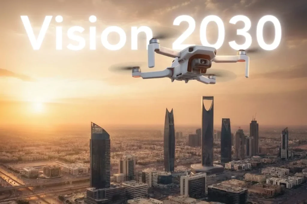
Economy under 1,000 Feet: The Rise of LAE in Smart Cities
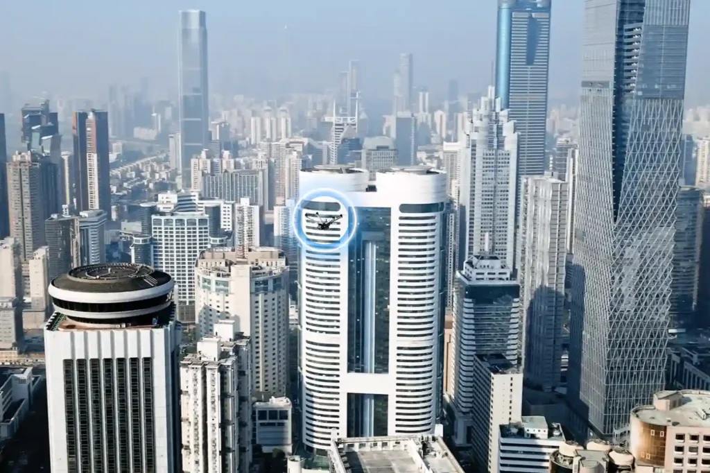
The Next Industrial Airspace Layer We often look at the sky and see empty space. However, a quiet revolution is happening just above our heads. This is the rise of the low altitude economy (LAE). This term refers to a new economic and operational domain occupying the airspace below 1,000 feet. It represents the next frontier for industrial efficiency. Global industries are moving fast. They are digitizing their airspace and adopting unmanned systems to perform autonomous inspections. This shift is not just a global trend; it is a critical component of Saudi Arabia’s Vision 2030. The Kingdom is building smart cities and transforming its industrial base. These massive projects require accurate, safe, and continuous aerial operations. Traditional ground methods cannot support this scale. The low altitude economy and industrial applications provide the only viable solution to manage these large-scale assets efficiently. Core Technologies Enabling the LAE To make this new economy work, we need a robust technological foundation. The LAE relies on a stack of advanced systems that ensure safety and predictability. I. The Technological Stack for Safe Operations Unmanned Traffic Management (UTM): We cannot have drones flying blindly. UTM acts like air traffic control for drones. It coordinates airspace, ensures compliance, and prevents collisions. BVLOS Frameworks: Real value comes when drones fly Beyond Visual Line of Sight (BVLOS). This framework establishes safe corridors for drones to operate over long distances, such as along pipelines, utility grids, and coastal zones. Autonomous Drone Stations: Efficiency demands persistence. Autonomous docking stations allow drones to land, charge, and deploy 24/7 without a human pilot on site. Remote Sensing Toolkit: The drone is just the carrier. The value lies in the sensors. We use LiDAR for depth, thermal imaging for heat detection, multispectral sensors for vegetation analysis, and methane detectors for gas leaks. Geospatial Data Infrastructure: All this data must go somewhere. We build high-resolution maps and GIS databases. These form the basis of digital twins, allowing operators to manage physical assets in a digital space. These systems interact seamlessly. They create a predictable and scalable workflow that transforms low altitude economy and industrial applications from a concept into a daily operational reality. Transforming Critical Sectors The application of this technology transforms how we manage the three pillars of modern society: Energy, Utilities, and Urban Development. II. Energy Sector Applications The energy sector demands the highest level of safety and monitoring. Pipeline Integrity: Drones monitor the Right-of-Way (ROW) along vast pipeline networks. They detect leaks and security breaches instantly, protecting the environment and the asset. Flare and Tank Inspection: We replace dangerous manual climbing with drone inspections. Drones perform visual, thermal, and Ultrasonic Thickness (UT) checks on flare stacks and storage tanks. This assesses corrosion and wall health without shutting down operations. Sustainability: Specialized sensors quantify methane and Greenhouse Gas (GHG) emissions. This data helps energy companies meet strict regulatory compliance and sustainability goals. III. Utilities and Power Infrastructure Grid reliability is non-negotiable. Drones ensure the lights stay on. Powerline Inspection: Drones capture high-resolution visual and thermal images of powerlines. LiDAR sensors measure the sag of the lines with centimeter precision. Vegetation Management: Overgrown trees cause outages. Drones analyze vegetation encroachment, allowing utility companies to trim trees only where necessary. Renewable Assets: As the Kingdom adopts green energy, drones inspect solar PV panels for dead cells and wind turbines for blade damage, ensuring maximum energy output. IV. Urban Development and Smart Cities Smart cities like NEOM require smart construction data. Digital Twins: Drones capture data to build 3D city models. These Digital Twins allow planners to simulate traffic, weather, and energy usage before building anything. Progress Tracking: Megaprojects move fast. Aerial surveys track construction progress day by day. This helps project managers catch errors early and keep the project on schedule. Environmental Monitoring: Sensors on drones monitor air quality and heat islands in urban areas. This data helps city planners design cooler, healthier living spaces. Accelerating Efficiency and Adoption The shift to the low altitude economy and industrial applications is not just about technology; it is about business results. V. Why LAE Accelerates Efficiency Cost and Frequency: Automated drones inspect assets more frequently at a lower cost. You can inspect a site daily instead of monthly. Human Safety: We remove humans from high-risk environments. No more climbing towers or entering confined tanks. Real-Time Data: Reports arrive in near real-time. This integration with enterprise systems allows for faster decision-making. National Scale: This technology supports cross-sector interoperability. Data collected for a road project can also help utility companies, supporting national-scale digital initiatives. VI. Pathway to Adoption Governments and industry operators must act now to build this ecosystem. Establish Readiness: Organizations must prepare their technical systems for BVLOS and UTM-aligned operations. Deploy Autonomy: Install autonomous drone stations to enable routine, high-frequency missions. Centralize Data: Build repositories to unify survey and inspection data. Start Pilots: Conduct pilot programs with measurable KPIs to prove the value. Ready to transform your low altitude economy energy, utility, or urban development projects? Let’s realize it through advanced sensing, processing, and data management platforms.
Drones as a Pillar of Vision 2030: Integrating National Strategy and Unmanned Aerial Systems
Saudi Arabia’s Vision 2030 is one of the most ambitious transformation programs in the world, aiming to diversify the economy, empower new industries, and deliver smarter, more sustainable cities. Achieving these goals requires advanced digital technologies, and drones are quickly proving themselves to be a pillar of this national strategy. Globally, drones have reshaped industries by cutting costs, reducing risks, and accelerating the delivery of projects. For the Kingdom, the potential is even greater. With its vast energy assets, ambitious smart city projects, and focus on sustainability, Saudi Arabia can lead the Middle East in drone adoption through forward-thinking regulation, public–private partnerships, and large-scale deployment across industries. Building Technical and Strategic Relevance Saudi Arabia’s Vision 2030 rests on three central pillars: creating vibrant societies, diversifying the economy, and building a sustainable future. Drones directly support these objectives by acting as scalable tools that capture, process, and deliver actionable data across the Kingdom’s critical industries. Vision 2030 Goals Supported by Drones Smart Cities Modern smart cities such as NEOM and The Line require live, accurate, and dynamic datasets to function. Drones generate digital twins of entire districts by combining LiDAR scans, RGB imagery, and multispectral data into GIS platforms. Urban mobility strategies also depend on drones for traffic analysis, congestion detection, and integration with UAV Traffic Management (UTM) systems, ensuring safe coexistence of drones and traditional air traffic. By automating city-wide monitoring, drones reduce the time to collect planning data from months to days, enabling urban developers to respond faster to growth challenges. Energy and Utilities Drones have already demonstrated their ability to transform inspections. For example, during a diesel tank inspection at an oil depot, drones reduced downtime from two weeks to just four hours, saving 13 days and 20 hours of lost operations. In utilities, drones inspect transmission lines and substations without cutting off power supply. Thermal cameras detect hotspots in transformers or insulators, while high-resolution zoom sensors identify cracks or corrosion before failure occurs. Compared to ground or rope-access inspections, drones deliver datasets that are both more comprehensive and safer, while reducing inspection costs by 50–70%. Agriculture and Food Security Saudi Arabia’s arid climate demands resource efficiency. Drones support precision agriculture by using multispectral cameras to detect crop stress, identify nutrient deficiencies, and guide irrigation schedules. Drones reduce manual labor costs by 30% and power consumption by 20% by optimizing input distribution and flight-based spraying. Yield prediction models improve accuracy when fed with drone-acquired NDVI (Normalized Difference Vegetation Index) data, allowing farmers to plan harvests and contribute to Vision 2030’s food security objectives. Environmental Sustainability Climate change and sustainability goals require persistent environmental monitoring. Drones equipped with methane detection sensors can detect and quantify leaks with high sensitivity. Frequent inspections reduce leak persistence and can cut emissions by 30% or more compared to traditional surveys. For air quality monitoring, drones fly pre-programmed routes equipped with 5 and PM10 sensors, providing real-time readings across industrial zones. In biodiversity management, thermal and multispectral cameras track wildlife movement, detect changes in vegetation cover, and monitor desertification patterns, helping the Kingdom align with its climate resilience strategies. Digital Infrastructure and Drone Integration The Kingdom’s future-ready economy requires robust digital infrastructure. Drones are not just tools for inspection; they are data-generation engines feeding national systems. GIS Databases: Drone imagery provides georeferenced data that feeds national geographic information systems, supporting planning, defense, and disaster response. LiDAR Mapping: High-density LiDAR scans build 3D terrain models accurate to a few centimeters, creating the foundation for digital twins and advanced civil engineering projects. Mobile Mapping: Drones extend mobile mapping into remote or hard-to-reach areas, where traditional survey vehicles cannot operate. Autonomy at Scale: With platforms like DJI Dock 3, drones operate autonomously, flying pre-programmed routes, charging automatically, and uploading data directly to the cloud. This ensures repeatable, standardized data collection that supports national-scale projects without requiring thousands of manual pilots. By integrating drones into digital infrastructure, Saudi Arabia positions itself to accelerate Vision 2030 goals across smart cities, energy diversification, agricultural sustainability, and climate action. Strategic Roadmap for Adoption For drones to become a true pillar of Saudi Arabia’s Vision 2030, adoption must move beyond isolated projects and pilot programs. It requires a strategic roadmap that ties national benefits to ecosystem development and regulatory modernization. National Benefits of Drones in Vision 2030 Operational Efficiency Across industries, drones have proven their ability to dramatically reduce inspection time and costs. In oil and gas, drones cut tank inspection time from two weeks to four hours, eliminating nearly 14 days of downtime. In agriculture, drone spraying reduces labor by 30% and lowers energy use by 20%, maximizing yields in arid regions. For utilities, drones reduce operational costs by 50–70% by eliminating the need for scaffolding, helicopters, or long shutdowns. Safety Enhancement Drones reduce the need for workers to scale flare stacks, powerlines, or telecom towers. By removing crews from these hazardous environments, accident risks drop by as much as 91%. This safety record strengthens compliance with workplace safety regulations while improving employee well-being. Data-Driven Governance High-resolution geospatial datasets from drones feed into GIS systems and digital twin models. This data enables ministries and municipalities to manage resources, monitor progress, and make evidence-based decisions. From monitoring Vision 2030 mega-projects like NEOM to tracking carbon emissions, drone data ensures progress is measurable and transparent. Multi-Stakeholder Ecosystem Development For drones to scale nationally, adoption must involve all stakeholders: Government Agencies: The General Authority of Civil Aviation (GACA) defines safe airspace rules for drone flights. Expanding frameworks for beyond-visual-line-of-sight (BVLOS) operations will be critical to unlocking logistics, transportation, and regional inspection projects. Industry Leaders: Oil and gas companies, utilities, and telecom operators are already deploying drones at scale. Sharing data and standardizing procedures will help expand adoption across sectors. Mega Projects: Initiatives like NEOM and The Line are testbeds for smart city drone integration, from urban mobility corridors to autonomous inspection systems. Academia and R&D: Universities and innovation centers can accelerate research into sensor technology, battery endurance, and autonomous navigation, ensuring Saudi Arabia
Retail Drone Delivery: Solving Last-Mile Logistics

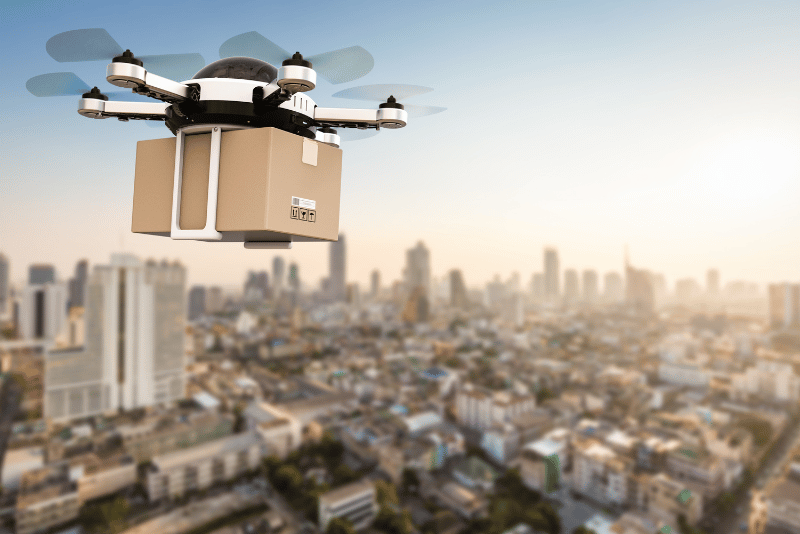
Retail drone delivery operations are transforming the last mile of the supply chain—a stage traditionally known for being the most expensive and inefficient. As e-commerce continues to expand, retailers face growing pressure to deliver goods faster while keeping costs low. Conventional delivery methods struggle to meet this demand due to road congestion, fuel costs, and human labor limitations. Autonomous drones are changing that. These unmanned aerial vehicles (UAVs) offer a new logistics model that combines speed, automation, and sustainability. Instead of navigating clogged streets, drones fly direct-to-door routes, completing deliveries in minutes rather than hours. Beyond speed, they provide a technical infrastructure that makes logistics smarter, not just faster. The Last-Mile Delivery Problem in Retail Last-mile delivery accounts for over 50% of total shipping costs in the retail sector. Whether in dense cities or sprawling suburbs, the final leg of delivery is where logistics companies lose both time and profit. Several factors contribute to this problem: Traffic Congestion: Urban deliveries are delayed by gridlock, stoplights, and parking restrictions. Inefficient Routing: Ground vehicles must follow complex delivery sequences, often with multiple stops and returns. Labor Shortages: Courier demand outpaces supply, leading to rising costs and staffing challenges. Failed Deliveries: Missed drop-offs require re-attempts, compounding costs and customer frustration. At the same time, consumer expectations are rising. Customers now expect same-day or even sub-hour delivery, especially for essential items. Retailers face the dual challenge of meeting these expectations while keeping operational expenses under control. The solution lies in rethinking logistics entirely—and that’s where drones come in. Inside Retail Drone Delivery Operations: How It Works Retail drone delivery operations are not just about flying drones—they’re about automating logistics at every stage, from order placement to doorstep delivery. Here’s how the system works: In order to Launch When a customer places an order eligible for drone delivery, the retailer’s system automatically prepares the package for UAV dispatch. Items are scanned, weighed, and packaged in lightweight containers designed for drone payload bays. The UAV then receives flight instructions via cloud-based fleet management software that integrates with the retailer’s e-commerce platform. Autonomous Flight Paths Once airborne, the drone navigates using GPS, RTK positioning, and onboard AI systems. It calculates the most efficient flight path, accounting for: Airspace regulations No-fly zones Weather conditions Obstacle avoidance (trees, buildings, other drones) Advanced UTM (Unmanned Traffic Management) systems coordinate drone traffic in real time, ensuring safe, collision-free operations. Package Handling and Delivery Most retail drones use a tethered delivery system. The UAV hovers above the delivery point, typically a customer’s backyard or porch, and lowers the package gently to the ground. This method protects fragile items and ensures safety without the drone needing to land. Once the package is delivered, the drone ascends and returns to base automatically. Fleet Management and Maintenance Drones are managed as part of a connected fleet. Software monitors: Battery health Flight logs Maintenance cycles Airspace permissions When not in use, drones recharge at automated docking stations or swap batteries through robotic systems, minimizing downtime and maximizing delivery throughput. Real-World Example: Walmart & Wing’s 19-Minute Drone Delivery Model A recent partnership between Walmart and Wing demonstrates how retail drone delivery works at scale. In 2023, Walmart launched the world’s largest drone delivery expansion in collaboration with Wing. Key highlights of this operation include: Delivery Times Cut from 60 Minutes to Under 19 Minutes: Traditional same-day delivery often takes an hour or more, but Walmart’s UAV service completes flights in under 20 minutes. Over 60,000 Eligible Items: Customers can order groceries, household goods, and over-the-counter medications by drone. Suburban Focus: The program targets residential areas where road traffic and delivery inefficiencies are most pronounced. This initiative has proven that drone delivery is not just a concept—it’s a scalable, profitable logistics solution that’s already improving customer satisfaction and lowering costs. Learn more: Wing & Walmart Drone Delivery Expansion Why Retail Drone Delivery Is the Future Drone delivery operations offer retailers a combination of cost savings, environmental benefits, and customer service improvements: Speed: Drones deliver within minutes, outperforming road-based couriers by flying direct aerial routes. Efficiency: UAVs reduce vehicle fuel costs, labor expenses, and maintenance associated with ground delivery fleets. Sustainability: Electric drones emit zero direct emissions, helping retailers meet carbon reduction goals. Automation: Advanced AI and real-time airspace management enable autonomous operations with minimal human oversight. Scalability: Drone fleets are easy to expand—adding new UAVs is faster and cheaper than scaling traditional delivery vehicles. As drone regulations evolve and airspace management systems mature, retailers will increasingly integrate UAV logistics into their fulfillment strategies. What was once a pilot program is now a mainstream operational model. Conclusion Retail drone delivery operations are solving the last-mile logistics crisis by making deliveries faster, smarter, and greener. The combination of autonomous UAV technology, real-world logistics integration, and customer-centric service models creates a system that benefits both retailers and consumers. The success of the Walmart & Wing partnership highlights the real potential of drone delivery at scale. By cutting delivery times to under 19 minutes, retailers are setting new benchmarks for efficiency and customer satisfaction. For retailers considering the next step in logistics innovation, drone delivery isn’t the future. It’s the present.
How Drone Delivery in Retail Doesn’t Only Ship Your Shopping

Drone delivery in retail is no longer a futuristic concept; it’s happening right now. As customer expectations shift toward faster, same-day fulfillment, retailers are turning to UAV technology to close the gap between warehouses and front doors. The last mile, historically the slowest and most expensive part of the delivery chain, is being reimagined through drone logistics. This shift is part of a much larger global trend. The delivery drone market, valued at USD 528.4 million in 2024, is projected to soar to USD 10.5 billion by 2034, reflecting a CAGR of 33.9%. This exponential growth is fueled by the rising demand for faster, more efficient last-mile delivery solutions, not only in retail and e-commerce, but also in healthcare, food delivery, and disaster response. As drone technology evolves, its payload capacity and operational range are expanding, making UAV logistics viable for a broader range of sectors. This transformation is exemplified by the recent partnership between Wing and Walmart, marking the world’s largest retail drone delivery expansion. By cutting delivery times from 60 minutes to under 19, the model proves that UAV logistics can redefine retail supply chains. From household goods to healthcare products, drones are unlocking a new era of rapid fulfillment across multiple industries. The Last-Mile Delivery Challenge The last mile of delivery has long been the most expensive and time-consuming stage in the logistics chain. Industry data shows that up to 53% of total shipping costs are attributed to the final delivery step, whether in urban neighborhoods or remote areas. Traditionally, this segment involves traffic congestion, labor-intensive routes, fuel expenses, and repeated failed deliveries. But beyond these costs, evolving customer expectations are driving a logistics transformation. Today’s consumers and organizations demand rapid, reliable, and specialized delivery services, whether it’s a grocery order arriving within 30 minutes, a life-saving medical supply during an emergency, or industrial components needed in remote locations. Drones are emerging as the scalable solution to meet these diverse delivery needs, bypassing ground-level constraints by taking to the skies. Diverse Drone Delivery Use Cases Modern drone delivery operations are no longer confined to parcel drops for e-commerce giants. With advances in payload capacity, airspace management, and flight control systems, UAVs are now solving last-mile challenges across multiple industries: 1. E-commerce & Retail Drones are streamlining rapid parcel delivery for online shoppers. A prominent example is the Wing & Walmart partnership, which has launched the world’s largest retail drone delivery expansion. Through this program, over 60,000 eligible items—including groceries, household essentials, and over-the-counter medicines—are delivered in under 19 minutes, compared to the typical 60-minute road-based logistics cycle. This reduces congestion, lowers emissions, and meets rising consumer demand for instant delivery services. 2. Healthcare and Pharma Logistics The use of drones in healthcare logistics addresses critical delivery challenges, especially during high-density events like the Hajj season in Saudi Arabia. In 2025, Terra Drone Arabia, in partnership with NUPCO and the Saudi Ministry of Health, deployed drones to deliver emergency medical supplies in under 6 minutes. This innovation is a major improvement compared to traditional delivery times of over 1.5 hours in crowded zones like Mina and Arafat. Using DJI M350 RTK drones with specialized transport boxes, Terra Drone ensured temperature-controlled delivery of critical medicines, supervised by a coordinated Unmanned Traffic Management (UTM) system to ensure safety and efficiency. Learn more about the TDSAxNUPCO Hajj Medical Delivery Project here. 3. Industrial Logistics Drones are increasingly used for industrial logistics, transporting parts and materials to offshore platforms, mining camps, and wind farms. In these sectors, delivery of essential components by UAV reduces downtime, bypasses difficult terrain, and eliminates the need for long-range trucks or helicopters. 4. Agricultural Supply Chain & Operations Agriculture is also benefiting from drone delivery, particularly for crop spraying, precision seeding, and high-value supply chain logistics. UAVs carry agricultural inputs directly to rural farms, reducing delivery lead times and optimizing planting and spraying cycles. 5. Public Safety & Disaster Response In emergencies, drones provide rapid deployment of first aid kits, food supplies, firefighting gear, and surveillance equipment. Whether responding to floods, wildfires, or medical emergencies, UAVs enable responders to reach areas that may be inaccessible by road. 6. Urban & Rural Last-Mile Logistics For both cities and remote communities, drones deliver direct-to-doorstep or remote-site packages, avoiding traffic bottlenecks and eliminating the need for ground-based infrastructure. UAVs are particularly useful in areas where traditional delivery vehicles face delays or operational barriers. Drone Payload Classes in 2025 The expansion of drone delivery applications is made possible by diverse payload capabilities that match specific delivery scenarios: Light (Small) Payload: Food delivery, retail parcels, and medical kits (0.3 – 5 kg). Medium (Commercial): E-commerce orders, healthcare logistics, and inspection tools (5 – 20 kg). Heavy Payload: Industrial logistics, agro-supply transport (20 – 220+ kg) Specialized Payload: Disaster relief, defense, military-grade delivery (50 – 500 kg). His classification allows drone logistics planners to deploy the right drone for the right task, whether it’s delivering a pizza, a critical vaccine, or heavy industrial parts. Why This Matters The last-mile delivery challenge is no longer just about consumer goods. It now includes critical sectors like healthcare, industry, agriculture, and disaster management. By expanding drone delivery use cases beyond retail, the logistics industry is unlocking new efficiencies, saving lives, and reducing environmental impact. Whether it’s Walmart delivering groceries in 19 minutes, Terra Drone Arabia transporting medical supplies during Hajj, or industrial sites receiving parts in remote zones, drones are proving that the skies are the future of fast, flexible logistics. How Drone Delivery Works in Retail Logistics At the core of drone delivery in retail is an integrated system that combines hardware, software, and cloud-based coordination. The workflow begins the moment a customer places an order, triggering an automated logistics pipeline that involves both physical drone deployment and digital task management. Order Processing and Payload Preparation Once an order is received, the system checks item eligibility for drone delivery based on weight, size, and packaging requirements. Most retail drones are optimized for small-to-medium parcels, typically
Advance Your Horizons: A Guide to Drone Career Path in 2025

The drone career path is no longer an emerging concept, it’s a well-defined route to high-value roles across industries that rely on precision, efficiency, and innovation. From flare stack inspections in oil & gas to aerial mapping in urban planning, drones have become a central part of modern operations. As we step into 2025, UAV professionals are becoming mission-critical to digital transformation efforts, particularly in regions like Saudi Arabia and the wider MENA area. Structured growth and proper certification aren’t just recommended — they are the foundation of long-term success in this field. The Starting Point: Entry-Level Drone Roles The first step into a UAV career often begins with support roles emphasizing learning by doing. Entry-level operators might assist with visual drone inspections of industrial assets, such as tanks, towers, or pipelines, or manage checklists during missions. These early positions are perfect for building technical awareness and field discipline. Foundational training in photogrammetry and GIS platforms like DJI Terra or ArcGIS Field Maps is commonly introduced at this stage. Additionally, formal certifications such as GACAR Part 107 (in Saudi Arabia) or equivalent national licenses ensure operators understand aviation safety, airspace rules, and mission planning, all essential to industrial compliance. Building Skills Through Certification and Field Experience Once the basics are in place, aspiring drone professionals should actively seek hands-on flight hours. The goal here is to become fluent with different payloads: thermal cameras, multispectral sensors, LiDAR scanners, and high-zoom RGB imaging systems. Industrial use cases, especially in oil & gas, power generation, and infrastructure — demand comfort with automated mission planning, waypoint routing, and live data interpretation. This is also the right time to dive into manufacturer training (like DJI Enterprise programs) or platforms such as Pix4D, FlightHub 2, and Terra Mapper to understand post-processing and mission management tools. In short, growing from operator to asset requires more than flying — it requires confidence in equipment, mission logic, and post-flight deliverables. Specializing in Industry Needs To stand out, professionals should tailor their skills to sector demands. For example, the oil & gas industry often requires familiarity with ultrasonic testing (UT) via drones, or non-destructive testing (NDT) using robotic systems like Voliro T. In agriculture, it’s all about multispectral mapping, NDVI analysis, and precision spraying logic. Each sector comes with its own vocabulary, safety culture, and data expectations. That’s why mid-level drone professionals must invest in contextual expertise: Utilities & power: risk-aware inspections, thermal fault detection Construction: BIM integration, volumetric analysis Renewable energy: panel array surveys, defect localization Urban planning: zoning data overlays, digital twin creation Software proficiencies become more important here too, with CAD, LiDAR data tools, and GIS integration forming the backbone of deliverables. Advancing to Mid-Level Roles With experience and specialization, many UAV professionals move into roles like Lead Operator or Mission Planner. These individuals oversee site planning, lead field teams, and ensure compliance with safety and flight protocols. They also contribute heavily to operational documentation — flight logs, asset reports, and pre/post-inspection forms. At this level, mentoring junior pilots and helping onboard new tech platforms is often part of the role. Professionals who excel here are the ones who balance technical confidence with operational discipline. People who don’t just fly well, but also communicate, document, and manage well. Reaching Leadership: Operations Manager or Technical Lead At the top of the drone career path are roles that go far beyond flight. UAV Operations Managers or Technical Leads manage entire drone programs, overseeing fleets, scheduling missions, setting internal SOPs, and liaising with regulators or enterprise clients. They often work closely with cross-functional teams: AI & data science units (for predictive analytics, anomaly detection) GIS departments (for model integration and spatial workflows) Compliance and safety teams (for audits, risk assessments, and reporting) Leaders in this space often participate in R&D discussions, vet new hardware, and pilot innovation projects, such as integrating digital twins, real-time mapping, or cloud-based remote inspections into day-to-day operations. This is where drone professionals evolve into decision-makers and strategists, shaping the future of industrial UAV adoption. Conclusion In 2025 and beyond, the drone career path is no longer limited to enthusiasts or specialists. It’s a legitimate, scalable career with entry points, vertical mobility, and global demand. The MENA region, especially Saudi Arabia under Vision 2030, is creating enormous opportunities for certified UAV professionals who combine technical excellence with industry understanding. Whether starting as a visual inspector or leading a national drone program, the career path is wide open. For those willing to invest in certification, specialization, and continuous learning, the drone industry isn’t just taking off. It’s landing big careers.
How Offshore Drone Delivery Cut Costs and Risks in Supply Chains

Offshore drone delivery is rapidly emerging as a critical logistics solution in the oil and gas sector, especially for companies operating remote rigs, FPSOs, and production platforms. Traditionally reliant on helicopters, supply vessels, and barges, offshore operations have faced decades of logistical bottlenecks—from harsh weather and safety concerns to soaring operational expenses. Today, drone-based aerial resupply is not just an innovative alternative; it’s a strategic shift toward safer, leaner, and more agile supply chain management. Redefining Offshore Logistics: From Helicopters to Hovering Payloads The conventional offshore supply chain involves extensive coordination. Spare parts, tools, medical kits, and sensitive documents typically travel from onshore bases via helicopters or crew boats—both high-cost, high-risk assets. Helicopter charters can exceed $5,000 per hour and come with strict weight limitations, not to mention the risk posed to human crews in storm-prone regions. In contrast, unmanned aerial vehicles (UAVs) drastically cut turnaround times, reduce dependency on weather windows, and eliminate crew-related safety hazards. A drone equipped with GPS navigation and autonomous flight systems can deliver small payloads (typically under 10 kg) in a fraction of the time and cost. Modern systems use encrypted GPS with RTK (Real-Time Kinematic) positioning, ensuring sub-centimeter precision for platform landings. Safety protocols include geofencing, failsafe return-to-home modes, obstacle avoidance, and real-time telemetry, enabling flights in complex marine airspaces. Real-Time Payloads, Real Results Aerial resupply missions typically focus on mission-critical deliveries, like diagnostic tools, calibration kits, SIM cards, data storage units, or medicines, especially when urgency outweighs weight. Operators can dispatch these UAVs autonomously from a control center, cutting down multi-hour marine trips to under 30 minutes. For example, Norwegian energy company Equinor has trialed drones to deliver 3D-printed parts to offshore facilities, demonstrating just-in-time delivery without the need to mobilize large support vessels. The result: reduced fuel costs, lower carbon emissions, and faster equipment availability. In Saudi Arabia and the UAE, where remote offshore facilities span large swathes of the Gulf, early trials have shown that UAVs operating within 20–30 km radii offer a reliable solution with low maintenance demands. With range extension through hybrid power systems or docking-and-charging buoys, future operations will push delivery ranges even further. Cost Efficiency at the Core While upfront investment in offshore drone delivery systems can vary, ranging from $50,000 to $200,000 depending on drone class and autonomy level, the return on investment becomes evident in months. Reductions in charter costs, fuel consumption, insurance premiums, and personnel risk translate to double-digit operational savings annually. Moreover, drones eliminate the need for a dedicated crew for short-haul deliveries. When compared to mobilizing a multi-tonne supply vessel for a 2 kg payload, the efficiency gain becomes undeniable. Another advantage lies in reduced wear and tear on infrastructure. With less reliance on heavy lifting cranes, helidecks, and crew handling, offshore platforms face fewer mechanical stressors and human error incidents. Addressing Safety and Environmental Risk Safety is a top priority in offshore logistics, particularly when dealing with flammable or hazardous materials. Drone-based delivery minimizes human interaction, keeping crews out of high-risk environments, especially during extreme weather or pandemic-related restrictions. Additionally, drones produce near-zero emissions per trip. Unlike diesel-powered vessels or helicopters, electric drones offer a low-carbon logistics channel, aligning with broader ESG goals and sustainability frameworks in the energy sector. See more about how this works. Drone flight paths can be pre-programmed to avoid congested air traffic zones and sensitive marine habitats, further reducing the operational footprint. Integration with Digital Offshore Ecosystems Offshore drone delivery doesn’t operate in a vacuum—it complements a larger ecosystem of digitalization. Paired with real-time asset monitoring, digital twins, and AI-based maintenance planning, drones serve as mobile links within the supply chain’s data layer. When connected to cloud platforms or on-premise control systems, drone telemetry can sync with inventory management software, triggering alerts for automatic dispatches based on consumption thresholds or predictive maintenance schedules. This tight integration not only streamlines inventory flows but also enables fully autonomous, demand-driven logistics, a paradigm shift from reactive resupply models. Navigating Challenges and What Lies Ahead Despite significant progress, offshore drone delivery still faces constraints. Payload limits remain a challenge—most commercial-grade drones can handle up to 10 kg, which is suitable for niche use cases but not bulk supply. Wind resistance and corrosive salt-air conditions also demand ruggedized designs and IP-rated enclosures. Regulatory frameworks in many regions still lag behind technological capability. Airspace restrictions, especially around oil fields and strategic marine zones, require clearances from multiple aviation and maritime authorities. However, this regulatory gap is narrowing with growing pilot programs and national digital transformation agendas, like Saudi Arabia’s Vision 2030 and the UAE’s Fourth Industrial Revolution Strategy. Innovations such as hydrogen-powered drones, drone swarms, and AI-based fleet coordination will expand the scale and scope of offshore drone applications. Companies that invest early will have a competitive edge in cost control, safety, and logistical agility. Conclusion Offshore drone delivery is no longer a concept on the fringe—it’s a rapidly maturing logistics solution delivering measurable gains in cost efficiency, operational safety, and sustainability. From minimizing the carbon footprint to increasing delivery frequency and reducing risks to human life, drone resupply offers real value across the oil and gas sector’s offshore operations. For companies navigating increasingly complex supply chains and environmental expectations, adopting drone technology may soon shift from a “nice to have” to a mission-critical necessity.
Agricultural Drones and The Impact on Farming Efficiency

Agricultural Drones are transforming the farming landscape, offering unprecedented precision and efficiency. These high-tech tools have revolutionized how farmers manage their crops, leading to significant improvements in productivity and sustainability. Precision in Planting and Seeding Agricultural drones provide unparalleled precision in planting and seeding operations. By using advanced GPS technology, these drones can plant seeds with exact accuracy, ensuring uniform distribution and optimal planting depth. This precision not only maximizes crop emergence rates but also reduces seed wastage and labor costs. Efficient Resource Management One of the most significant impacts of drones in farming is the efficient management of resources. Traditional farming methods often lead to the over-application of water, fertilizers, and pesticides. Drones equipped with multispectral sensors can measure soil moisture and nutrient levels accurately. This data allows farmers to apply inputs precisely where they are needed, minimizing waste and environmental impact. For example, drones can create detailed maps that show variations in soil conditions across a field. Farmers can then use these maps to implement site-specific management practices, such as adjusting irrigation schedules or applying fertilizers only in deficient areas. This targeted approach not only conserves resources but also enhances crop health and yields. Time and Labor Savings Drones in agriculture significantly reduce the time and labor required for various farming tasks. Traditional methods of crop monitoring and field surveys are labor-intensive and time-consuming. Drones, however, can survey large areas quickly and efficiently, providing real-time data that farmers can use to make informed decisions. This automation allows farmers to focus on other critical aspects of farm management, ultimately leading to increased productivity. Additionally, the ability of drones to perform tasks such as spraying pesticides or fertilizers reduces the need for manual labor in hazardous conditions, improving safety and efficiency on the farm. Improved Yield Forecasting Another crucial benefit of agricultural drones is improved yield forecasting. By analyzing data collected from aerial images, drones can provide accurate predictions of crop yields. These predictions help farmers plan their harvests, manage labor and resources, and make informed marketing decisions. Advanced algorithms and machine learning techniques enhance the accuracy of these forecasts, enabling farmers to optimize their operations and maximize profitability. In A Nutshell The impact of agricultural drones on farming efficiency is profound. From precision planting and efficient resource management to time savings and improved yield forecasting, these high-tech tools offer numerous benefits. As technology continues to evolve, the adoption of drones in agriculture is set to increase, promising even greater enhancements in productivity and sustainability. These insights into the role of agricultural drones underscore their significance in modern farming practices, making them indispensable tools for the future of agriculture. Read more here: Better Growth, Better Life
How Close Are We to Make Drone Delivery a Reality?
Drone Delivery: How Far from Reality? Drone delivery concept is a thrilling glimpse into the future of logistics and e-commerce. But how close are we to making this revolutionary idea a part of our everyday lives? Let’s explore the current landscape, the potential benefits, and the challenges that need to be overcome. The Current Landscape of Unmanned aerial vehicle (UAV) shipping Several major companies, including Amazon and Google, have made significant strides in Unmanned aerial vehicle (UAV) shipping technology. Pilot programs have successfully demonstrated that drones can deliver small packages quickly and efficiently. However, widespread implementation of Unmanned aerial vehicle (UAV) shipping services is still constrained by regulatory challenges, technological limitations, and public acceptance. Also Read: The Financial Advantages of Drones in Oil & Gas Operations The Prospects and Challenges of Drone Delivery Drone delivery holds immense promise. It could revolutionize last-mile delivery, reducing delivery times, and decreasing carbon emissions. However, challenges persist. Regulatory frameworks need to be developed to manage drone traffic and ensure safety. Technology must evolve to enable drones to navigate complex environments and handle larger payloads. Moreover, public acceptance and trust in Unmanned aerial vehicle (UAV) shipping services need to be fostered. Read More: The Race For Last Mile Drones The Future of Drone Delivery While challenges exist, the future of Unmanned aerial vehicle (UAV) shipping is promising. With continuous advancements in drone technology, regulatory bodies adapting to the changing landscape, and increasing public acceptance, the reality of Unmanned aerial vehicle (UAV) shipping services is within reach. It may not happen overnight, but we are undoubtedly on the cusp of a delivery revolution. Read More: Research suggests drones more efficient for last-mile deliveries